Blog

Niagara Falls Stops Flowing (1848)

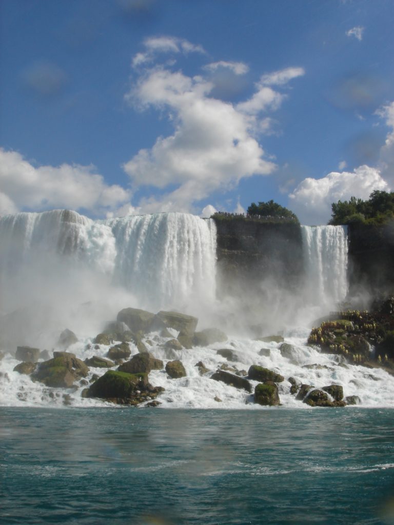
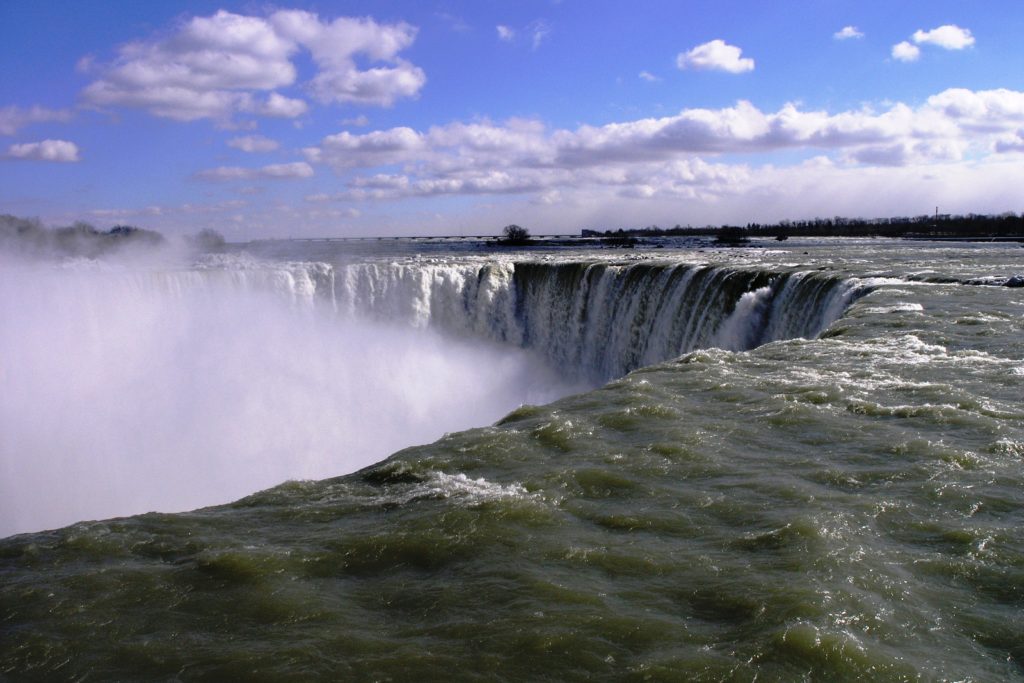
If you’ve ever been to Niagara Falls, you know what an overwhelming experience it is.  Massive quantities of water cascading over the falls, while you stand just feet away from the edge.  Or floating on the Maid of the Mist, all that water crashing down around you.  Now, just imagine if it stopped.  Unimaginable, you say?  True, except for once—beginning on March 29, 1848 and continuing for two days.

American Falls (photo by Poniol60)

            The winter of 1848 had been relatively mild, but still Lake Erie was covered with ice.  As spring arrived, a massive gale blew from the southwest for several days, pushing loose ice towards the mouth of the Niagara River.  All the ice couldn’t fit into the river, so it began to accumulate at the river mouth, becoming a massive ice dam.  The ice dam stopped the flow of the river, the source of water for Niagara Falls.

            On the evening of March 29, farmer Jed Porter took his usual walk along the river near American Falls.  Instead of the familiar roar of the falls, all he heard was silence.  The falls, both American and Horseshoe, had become a trickle.  By morning, the water wheels that had been fed by the river had stopped turning, closing mills and factories along the river.  Many people thought the biblical prediction of the end of the world had arrived.

            Once word reached the area that an ice dam on Lake Erie was the cause of the stoppage, anxiety was replaced by curiosity.  Thousands of people came to see the exposed cliffs and river bottom.  The more adventurous scrambled down to the river bed, picking up souvenirs of guns, bayonets, tomahawks and other items lost during the War of 1812.  Workers for the excursion boat, Maid of the Mist, blasted away rocks that were navigation hazards.  The U.S. Cavalry rode along the river bed, apparently just for the fun of it.

            The next day, winds shifted and the ice dam broke.  By the evening of March 31, the river was full and the falls were flowing once again.  To prevent any repeat of the phenomenon, a boom was stretched across the mouth of the Niagara River that prevents ice from building up.  Niagara Falls has been flowing ever since. 

Horseshoe Falls from the edge (photo by Daniel Mayer)

            Tourism is important, of course, but even more important is the electricity production associated with Niagara Falls.  Water wheels had operated around the falls since the mid-1700s, powering mills and factories.  The first hydro-electric plant associated with the falls opened in 1882, serving the local area.  Today, five hydro-electric plants (3 in Canada, 2 in the U.S.) generate electricity that supplies about 25% of all electricity used in New York State and the Province of Ontario.  A range of 60-75% of all the water in the Niagara River is diverted to supply this power—which means that Niagara Falls is carrying only about one-third of the flow that nature intended.

            One final note—U.S. engineers did stop American Falls, the smaller of the two main cascades, once.  In 1969, the Army Corps of Engineers built a coffer dam on the river above the falls, diverting the flow to Horseshoe Falls.  They stopped the flow so they could decide how to remove the rocks that had accumulated at the base of American Falls and threatened to turn the falls into a rapids.

            Even the ambitious Army Corps couldn’t handle this one, however.  They humbly decided to let nature handle things, removed the dam and turned on the falls again.  A good decision, because, as we all know, it’s not nice to fool Mother Nature!

References:

Alfred, Randy.  2010.  March 30, 1848:  Niagara Falls Runs Dry.  Wired, March 30, 2010.  Available at:  https://www.wired.com/2010/03/0330niagara-falls-stops/.  Accessed March 26, 2019.

Bailey, George.  2018.  Did Niagara Falls ever stop flowing?  Niagara Falls Canada, August 1, 2018.  Available at:  https://www.niagarafallstourism.com/blog/did-niagara-falls-ever-stop-flowing/.  Accessed March 26, 2019.

Niagara Falls History.  Niagara Power Generating Quick Facts.  Available at:  https://www.niagarafallsinfo.com/niagara-falls-history/niagara-falls-power-development/the-history-of-power-development-in-niagara/niagara-power-generating-quick-facts/.  Accessed March 26, 2019.

Niagara History.  2012.  The day Niagara Falls stood still.  Available at:  http://www.niagarafrontier.com/fallsstopped.html.  Accessed March 26, 2019.

NY Falls.  Electric Power Generation at Niagara.  Available at:  http://nyfalls.com/niagara-falls/faq5/.  Accessed March 26, 2019.

Joseph Bazalgette, London’s Sewer King, Born (1819)

In the mid-1800s, London’s Thames River was a sewer.  A huge, foul, disease-causing cesspool fed by the wastes of London’s exploding human population.  Something had to be done, and Joseph Bazalgette did it.

            Joseph Bazalgette was born on March 28, 1819, the son of a naval engineer (died 1891).  Like his father, he also became an engineer.  He designed and built railroads as part of the enormous expansion of the railway system of Great Britain during the early 19th Century.  Exhausted by the scale and pressure of the work, he eventually returned to London and took up work as an engineer for the newly formed Metropolitan Board of Works.

Sir Joseph William Bazalgette, 1877 (photo by Lock & Whitfield, National Portrait Gallery, London)

            And sewers became his major task.  London’s sanitary system was a mess.  Mostly, human waste was just washed into small streams that flowed to the Thames River.  The streams were noxious slurries that sloshed back and forth with the tides and mixed with drinking water supplies, including the Thames River itself.  Because of this contamination, cholera became an epidemic in London, killing more than 30,000 people at mid-century.  A particularly hot and dry summer in 1858 caused the “Great Stink”—the overwhelming putrid smell of the Thames River.  In the riverside Parliament, curtains were doused in chlorine to freshen the air and prevent disease.  It didn’t help, and Parliament passed legislation ordering the city’s engineers to fix it.

            Joseph Bazalgette gladly accepted the task.  He designed a series of sewers that captured the wastewater coming from homes and businesses.  These sewers connected to a massive sewer that paralleled the shore of the Thames River and carried the foul water many miles downstream.  To avoid digging up miles of central London, Bazalgette proposed narrowing the river and building massive “embankments” to hold the sewers and other needed facilities—including electrical and telegraph lines and underground trains.  At the time, his plan was the largest civil engineering project in the world.  So much for avoiding big scale and high pressure projects!

1890s postcard of the Thames Embankment (photo by Photochrom Print Collection)

            The work began in 1859 and continued for 16 years.  Under Bazalgette’s leadership, the city built 1100 miles of street sewers and 82 miles of main sewers.  The main sewers lie beneath the Thames, Chelsea and Albert Embankments that make up the sides of the Thames River in central London.  The main sewers are three feet in diameter, in an inverted tear-drop shape.  This shape allows the sewers to take massive amounts of water at high flows and still operate effectively at low flows, removing waste along the narrower bottom of the pipe.

            Bazalagette’s approach was pure genius.  He calculated the size of a sewer to handle all of London’s waste—and then doubled the size.  To this day, his sewers continue to be the primary sanitary system for London (but a major expansion of the system is now underway).  His work stopped epidemics of cholera and other water-borne diseases in London, allowing the Thames to recover as both a source of drinking water and habitat for fish and other aquatic organisms.  And his riverside embankments, with sewers and train lines below and roads, paths and gardens above, are a major element of London’s vibrant urban environment.

Cartoon of Bazalgette as the sewer king (Punch Magazine, 1 December 1883; Welcomme Collection)

            Bazalgette was knighted by Queen Victoria and honored in other ways during his life.  The only permanent memorial to him, however, is a modest bust on the wall of the Thames Embankment.  The inscription reads, “Flumini vincula posvit”—“He put the river in chains.”  More appropriate, I think, would be that he set the river free, free of the pollution that was killing it and us.

References:

BBC History.  Joseph Bazalgette (1819-1891).  Available at:  http://www.bbc.co.uk/history/historic_figures/bazalgette_joseph.shtml.  Accessed March 25, 2019.

Hansen, Chad.  Sir Joseph Bazalgette.  Cholera and the Thames.  Available at:  https://www.choleraandthethames.co.uk/cholera-in-london/the-big-thames-clean-up/sir-joseph-bagalgette/.  Accessed March 25, 2019.

Londontopia.  Great Londoners:  Joseph Bazalgette—The man who ended the Great Stink.  Available at:  https://londontopia.net/columns/great-londoners/great-londoners-joseph-bazalgette-man-ended-great-stink/.  Accessed March 25, 2019.

Trans-Alaska Pipeline Begun (1975)

One of America’s most ambitious projects—economic and environmental—began on March 27, 1975, when the first pipe was laid for what would become the Trans Alaska Pipeline.  After years of debate about the value and possible impact of the pipeline, the outcome has been remarkably positive.

            Oil was discovered in the far north of Alaska in March,1968.  The location was Prudhoe Bay, adjacent to the northern shore of Alaska, 100 miles above the Arctic Circle.  The find turned out to be the largest oil field ever discovered in the United States, estimated at the time to contain about 10 billion barrels of recoverable oil. 

            The problem, of course, was how to get the oil from the North Slope of Alaska to the rest of the country.  The sea was frozen for much of the year, preventing oil tankers from carrying the oil to other locations.  The solution was to build a pipeline to the nearest port that was ice-free all year long.  That port was at Valdez, Alaska, on the state’s southern shore, 800 miles from the oil field.

Route of the Trans-Alaska Pipeline; “PS” refers to pumping stations (figure by Flominator)

            Distance wasn’t the only problem.  A pipeline from Prudhoe Bay to Valdez would need to cross three mountain ranges, span 34 major rivers and 700 smaller streams.  It would pass through a major earthquake zone—and Alaska was known for its severe earthquakes.  Temperature extremes were brutal, from frigid cold to blistering heat.  The route also passed through “permafrost,” the permanently frozen ground that would melt if it was disturbed, breaking a buried pipeline.  

            There were also major issues of land ownership, involving Native Americans in Alaska and state versus federal land holdings.  And at just about the same time, the National Environmental Policy Act was being passed, requiring impacts statements about a place that was poorly known and a project of a type and scale that had never been tried before.

            Amidst all these issues, however, the oil producing countries of the Middle East slapped an embargo on oil exported to the United States.  Oil supplies dropped, causing prices to rise and shortages to affect the lives of every American (read about the oil embargo here) .  Faced with the possibility of no gas for cars, the federal government quickly responded, solving Native American land issues, environmental processes and other impediments and approving the “Trans-Alaska Pipeline Authorization Act” in 1973.

An elevated section of the pipeline, which protects the permafrost soil below the pipe (photo by Ryan McFarland)

            And, so, on March 27, 1975, the first section of pipe was welded into place. The pipeline was finished on May 31, 1977—with a “golden weld” reminiscent of the golden spike that completed the trans-continental railroad a century earlier (read about the golden spike here).  It has proven to be an engineering masterpiece.  Of the 800 miles, about half are buried, in the normal style of pipelines.  The other half of the pipeline, however, could not be buried because of permafrost.  Instead, the pipe is suspended on masts that hold it several feet above ground.  The masts are called “vertical support members,” or VSMs.  Invented for this purpose, they contain liquid that transfers heat from the masts and the adjacent ground, keeping the permafrost frozen and the pipe securely mounted.

            The pipe itself sits loosely on the supports, so that it can move with changes in the local topography.  The path is a zigzag, which allows the pipeline to move more extensively during earthquakes, without rupturing.  Although Alaska has experienced many earthquakes during the 40-year life of the pipeline, no earthquake related leaks have occurred.

Alaskan caribou (photo by Dean Biggins, U.S. Fish and Wildlife Service)

            When the pipeline was planned, the impact on caribou was a major concern.  Some predicted that caribou would not cross the pipeline, either by passing under it or going over it where passages were provided, causing disruption of breeding and decline of the populations.  Happily, caribou have proven quite resilient.  The population most likely to be affected, the Central Arctic Herd, had about 5,000 animals in the mid-1970s.  It has grown steadily, reached more than 70,000 in the early 2000s and now numbering about 25,000 (all caribou populations in Alaska have undergone large fluctuations in abundance in this century.

            In general, the environmental impacts of the Trans Alaska Pipeline have been minimal, especially when the massive nature of the project is considered.  The pipeline has carried 17 billion barrels of oil over its life, an average of 1.8 million barrels per day.  At one time, the pipeline produced 20% of America’s domestic oil supply.  Sometimes, the system gets it right.

References:

Alyeska Pipeline.  Pipeline Facts.  Available at:  https://www.alyeska-pipe.com/TAPS/PipelineFacts.  Accessed March 25, 2019.

American Oil & Gas Historical Society.  Trans-Alaska Pipeline History.  Available at:  https://aoghs.org/transportation/trans-alaska-pipeline/.  Accessed March 25, 2019.

Circum Arctic Rangifer Monitoring and Assessment Network.  Central Arctic Herd.  Available at:  https://carma.caff.is/herds/538-carma/herds/589-central-arctic.  Accessed March 25, 2019.

Hobson, Margaret Kriz.  2017.  How Spiro Agnew helped save the Trans-Alaska project.  E&E News, August 8, 2017.  Available at:  https://www.eenews.net/stories/1060058484.  Accessed March 25, 2019.

Marjorie Harris Carr, Pioneering Florida Conservationist, Born (1915)

Florida is one of the world’s most biologically and environmentally interesting places.  And we owe much of our opportunity to enjoy Florida’s natural resources to a woman who persevered over her long lifetime to protect those resources for us.

            Marjorie Harris was born on March 26, 1915, in Boston, but moved to Bonita Springs, Florida, at age 3 with her parents (died 1997).  Both her parents were naturalists, and they nurtured a similar love of nature in their daughter.  Later, she would write that her parents “knew the answers to the questions I had about the natural world.”

Marjorie Harris Carr (photo by Florida Memory)

            That nurturing led her to enter college as a zoology major.  She graduated from what is now Florida State University in 1936 and sought a graduate program to study ornithology, but such programs were just for men in those days, and she sought work instead.  She became a technician at the Welaka National Fish Hatchery in central Florida—the first female wildlife technician ever employed by the U.S. Fish and Wildlife Service.

            While working at the fish hatchery, she fell in love with the Ocklawaha River and its associated wetlands.  She reflected on her love of nature in 1990:

 “What a pleasure it was to go into the woods and fields and, by recognizing a set of characteristic key plants, be able to put a name to a particular association of plants. It was thrilling to look at a landscape and think perhaps you knew its past history and its future. The ability to “read” a landscape provides the kind of pleasure that comes from a knowledge of Bach or Shakespeare or Van Gogh. It is a pleasure that increases with your knowledge and understanding of the ecology of Florida, and it lasts an entire lifetime.”

            She also fell in love with a young herpetologist, Archie Carr.  They married, but kept the marriage a secret for some time because a federal law at the time discriminated against married women holding jobs that men could do.  Within a year, Marjorie Carr broke the male barrier in graduate school, entering the biology program at the University of Florida.  She received her M.S. in 1942. The Carrs then spent several years in Honduras, where Marjorie studied tropical birds and built a large collection of specimens which she eventually donated to the University of Florida Museum.

Paynes Prarie, a state preserve of grasslands and wetlands near Gainesville

             Once back in Florida, she dove into work as an environmental advocate.  Working through the Gainesville Garden Club, she led efforts to protect Paynes Prairie, a nearby wetland prairie ecosystem that had been studied by the 18th Century naturalist William Bartram.  Paynes Prairie is now a 20,000-acre state preserve with a famous “eco-passage” allowing animals to travel under a busy highway that bisects the park.  She joined and led several other conservation groups, emphasizing educational programs. 

            Carr became a household name in the late 1960s when she undertook a campaign to stop the Cross Florida Barge Canal.  The canal had long been proposed to allow ships to cross the state, avoiding the long trip around the Florida Keys.  President Kennedy approved the canal in 1963, and construction began.  Carr understood that the canal would cause massive changes in hydrology, specifically impacting her beloved Ocklawaha River.  Almost single-handedly, she kept up the pressure to stop the project.  She co-founded the Florida Defenders of the Environment in 1969 and served as its president for 30 years.  She led the writing of a report on the environmental impacts of the canal that became the model for the National Environmental Policy Act’s requirement for “environmental impact statements” as part of all federal projects.

The Santos Trail is part of the Marjorie Harris Carr Greenway that replaced the beginnings of the Cross Florida Barge Canal (photo by Ebyabe)

            That report did its work, convincing scientists, politicians and the public that the canal was a bad idea.  In 1971, President Nixon cancelled the project and the state of Florida followed suit.  The parts of the canal that had been built and the remainder of the lands purchased for the route are now a conservation greenway, named for Marjorie Harris Carr.  A later governor of Florida said that Carr’s “efforts to deauthorize the Cross Florida Barge Canal began with one person and ended years later with thousands of citizens convincing their elected representatives of the detrimental nature of this project.”

            Carr should be recognized as a pioneering environmental activist, of course, but even more impressive is the kind of activist she was.  She believed that facts and science should drive decisions, not emotion or fear-mongering.  She said, “I am an optimist.  I also believe that Floridians care about their environment.  If they are educated about its perils, if they are never lied to, they will become stewards of the wild places that are left.”

References:

Florida Defenders of the Environment.  Marjorie Harris Carr.  Available at:  https://fladefenders.org/history/marjorie-harris-carr/.  Accessed March 21, 2019.

Infoplease.  Marjorie Harris Carr Biography.  Available at:  https://www.infoplease.com/people/marjorie-harris-carr.  Accessed March 21, 2019.

Isabella.  2017.  Marjorie Harris Carr:  A Champion of Florida’s Natural Resources.  The Florida Memory Blog, April 22, 2017.  Available at:  https://www.floridamemory.com/blog/2017/04/22/marjorie-harris-carr-a-champion-of-floridas-natural-resources/.  Accessed March 21, 2019.

Norman Borlaug, Father of the Green Revolution, Born (1914)

Several of the people highlighted in this conservation calendar have earned names like “father of conservation,” or “godmother of sustainability.”  But in my mind, only one of these father or mother figures stands out as so astoundingly worthy of such a name.  His name is Norman Borlaug, known as the “Father of the Green Revolution.”

Norman Borlaug as a wrestler at the University of Minnesota (photo by U. Minnesota Dept. of Plant Pathology)

            Norman Borlaug was born in 1914 in a small town of northeastern Iowa.  He was the son of Norwegian immigrant farmers.  Like his neighbors and friends, he worked hard to help his family on the farm and also worked hard in school.  He was a strong, active boy who took to wrestling as a sport.  As a forestry student at the University of Minnesota, he also wrestled competitively (and eventually was inducted into the NCAA Wrestling Hall of Fame).

            But wrestling with the world’s food issues became his fundamental fight.  Although he loved forestry—and the nature that it allowed him to enjoy—he switched to studying plant pathology as a graduate student, captured by the possibility of fighting against famine.  He graduated in 1942 with a Ph.D. in agronomy, and shortly thereafter was hired as part of a Rockefeller Foundation program to improve wheat yields in Mexico.

            For the next 15 years, Borlaug and his colleagues labored to develop better wheat.  First they developed strains resistant to diseases like “rust,” then added drought resistance and higher production.  But the plants grew so well—tall and full of grain heavy heads—that the stems collapsed from the weight.  So, they cross-bred their strains with dwarf varieties from Japan.  The results were spectacular.  Mexico went from producing half the wheat they needed to satisfying all their domestic needs and exporting food to other nations.

Norman Borlaug in his later years

            Borlaug had become famous in the developing world for his leadership in transforming agricultural production.  He was an unstoppable force in the field, never daunted by the amount or difficulty of the work, scientifically or physically. He overcame the reluctance of local farmers for new ideas, as he learned their language and their culture.  He navigated political processes with honesty and integrity.   With the success of his work in Mexico, he was asked to produce the same miracles elsewhere, and he did so—in Asia, the Middle East and, with less success, Africa. 

            For his efforts, Norman Borlaug became known as the “father of the green revolution.”  The green revolution was an entirely new approach to agriculture that used all aspects of modern technology to enhance production.  First came improved hybrids, but Borlaug recognized the importance of other aspects as well, including irrigation, fertilization, pest control and the availability of good rural roads.  The transformation of agriculture in these ways eliminated the famines that had plagued the developing world.

The front of the Congressional Medal of Freedom awarded to Norman Borlaug (sculpted by Phebe Hemphill for U.S. Mint)

            In 1970, he was awarded the Nobel Peace Prize.  Borlaug’s selection was the first to recognize that peace was not possible if people were starving and if their environment was not sustainable.  He is credited with saving over 1 billion lives.  Let that sink in for a moment.  1 billion lives.  At the Nobel ceremony, he was recognized as the “indomitable man who fought rust and red tape…[and] who more than any other single man of our age, has provided bread for the hungry world.”  He has received similar recognitions from many countries, including the US. Medal of Freedom, our country’s highest civilian award. 

            Norman Borlaug never forgot that the base of this success was pragmatism—putting science to work to improve people’s lives (he had no interest in pursuing “academic butterflies”).  And he never stopped working directly to help people.  When his Nobel Prize was announced, he was deep in a wheat field in rural Mexico.  His wife drove an hour to find him and bring him back to take calls from reporters.  Sorry, he said, he and his crew were in the middle of recording data, and he went back to work.  Eventually, the reporters found him—still at work in the field.

Norman Borlaug with his favorite audience–students, in this case from Nigeria (photo by U.S. Diplomatic Mission to Nigeria)

            I met Norman Borlaug about the time he was turning 90.  He came to North Carolina State University to speak.  Between speeches, we thought he should meet with university leaders, or at least take a rest.  He wasn’t interested in either.  He wanted to meet students. We took him to a middle school, so he could talk to young people about becoming scientists to help the world.

            Although Wangari Maathai (learn more about her here) is lauded as the first environmentalist to win the Nobel Peace Prize (and I often say that, too), I think it more accurate to cite Normal Borlaug for that honor.  He loved nature, but he knew that nature could not be maintained in a world of hungry people.  Today, we call that sustainability.  Borlaug said,

“To this day, I enjoy nature, the luxury of undisturbed wilderness, forests, mountains, lakes, rivers and deserts and their wildlife.  But I also know that the greatest danger to their perpetuity is the pressure of human population.”

Let that sink in, too.

References:

Nobel Prize Organization.  Norman Borlaug, Biographical.  Available at:  https://www.nobelprize.org/prizes/peace/1970/borlaug/biographical/.  Accessed March 14, 2019.

Quinn, Kenneth. M.  2008.  Norman Borlaug, Extended Biography.  World Food Prize Organization. Available at:  https://www.worldfoodprize.org/index.cfm?nodeID=87449&audienceID=1.  Accessed March 14, 2019.

University of Minnesota.  The significance of Borlaug.  Available at:  https://borlaug.cfans.umn.edu/unparalleled-achievements.  Accessed March 14, 2019.

Girl Scouts Founded (1912)

Ask most people about Girl Scouts, and the answer will probably be, “Cookies.”  But the organization is, of course, much broader and more important to the lives of girls than just Samoas and Tagalongs.  Just like the Boy Scouts, the Girl Scout movement has had an incredible influence on young girls—and on the environment we value so much.

            The idea began through the efforts of Juliette Gordon Low.  Low was born in Savannah, Georgia in 1860, child of a prominent and wealthy family (died 1927).  She was well educated and travelled widely.  She met her future husband, the also wealthy William Low, while traveling in England.  They were married when Low was 26 and kept homes in both London and Savannah.  The marriage proved unhappy and childless, and Low was divorcing him when he died in 1905.

Juliette Gordon Low (on right) with members of the first Girl Scout troop

            While living in London, she became friends with Robert Baden-Powell, the founder of the Boy Scouts (learn more about Baden-Powell here).  Low liked the scouting idea and realized that a companion program for girls was needed.  She led several troops of Girl Guides, as they were called, in England.  When she moved back to Savannah, she decided a U.S.-based program was needed, telling a cousin, “I’ve got something for the girls of Savannah, and all of America, and all the world, and we’re going to start it tonight!”

            That night, March 12, 1912, she formed the first Girl Scout troop with 18 girls as members.  Low was correct—this was something that was needed and would grow.  From those 18 original scouts have come more than 50 million Girl Scout alumnae.  Currently about 2.5 million girls and leaders are involved in the U.S, and troops operate in 92 countries.

The first Girl Scout “Naturalist” badge, 1913 (photo by Girl Scouts of America)

            Right from the start, Juliette Gordon Low wanted girls to be outdoors, actively enjoying, learning about, and taking care of nature.  This was part of the Progressive Era in the U.S., offering new opportunities and perspectives about society and life.  Low wanted girls to be expert at homemaking, given that most of them would serve that role, but she also wanted them to have a broader context for that life—and the natural environment could provide that context.  So, from the beginning, she led girl scouts on outdoor endeavors.  An original Girl Scout badge was the “Naturalist,” and the original Girl Scout Handbook said, “For in this United States of ours we have cut down too many trees and our forests are fast following the buffalo…so let us plant trees now.”

            From that origin, environmental stewardship has become a dominant program for Girl Scouts.  First-lady Lou Hoover, a fervent outdoorswoman, took over from Low as head of the Girl Scouts in 1920, elevating the environmental program even higher.  Nature activities were officially made part of the program in 1924, through the efforts of the organization’s naturalist, Dr. Bertha Chapman Cady.  In 1944, the girl scouts began creating wildlife conservation areas, named in honor of Hoover.  Today, 66 sanctuaries protect more than 9,000 acres.

Girl Scouts on a hike (photo by USFWS Mountain-Prairie region)

            In the 1970s, the Girl Scouts created a national Eco-Action program, building on the emerging environmental movement of the times.  The number and variety of environmental stewardship projects continues to grow and evolve, tying together leadership, science and environmental skills.  But it all goes back to a 51-year-old widow who decided to make the world a better place by spending her time and money for the benefit of every G.I.R.L.—go-getter, innovator, risk-taker, leader. 

References:

Encyclopedia Britannica.  Juliette Gordon Low, American Leader.  Available at:  https://www.britannica.com/biography/Juliette-Gordon-Low.  Accessed March 7, 2019.

Gambino, Megan.  2012.  The Very First Troop Leader.  Smithsonian, March 7, 2012.  Available at:  https://www.smithsonianmag.com/history/the-very-first-troop-leader-116645976/.  Accessed March 7, 2019.

Girl Scouts of America.  The Girl Scout Difference.  Available at:   https://www.girlscouts.org/en/about-girl-scouts/the-girl-scout-difference.html.  Accessed March 7, 2019. 

Girl Scouts of America.  Juliette Gordon Low, A Brief Biography.  Available at:  https://www.girlscouts.org/en/about-girl-scouts/our-history/juliette-gordon-low.html.  Accessed March 7, 2019.

Girl Scouts of America.  Girl Scouts’ Powerful Legacy of Environmental Stewardship.  Available at:  https://www.girlscouts.org/en/about-girl-scouts/girl-scouts-and-the-environment/stewardship.html.  Accessed March 7, 2019.

Save the Redwoods League Founded (1918)

At one time, redwoods covered a large area of northern California, both along the coast and inland.  But lumbering and other clearing had reduced the area of these majestic forests substantially by 1900.  Then, some folks decided to do something about this—and the Save the Redwoods League was formed.

Historical photo of a 25-foot-diameter giant sequoia log

            The origin goes back to a car trip taken by three conservationists—John Merriam, Madison Grant and Fairfield Osborn—in 1917.  After Stephen Mather became the first Director of the newly created National Park Service, he encouraged the three to take a journey through northern California to assess the status of the redwood forests (learn more about Mather here). They traveled up the coast on what was called the “redwood road,” partially because it passed through redwood forests and partially because sections of the road were lined with redwood planks.  They found beautiful forests of awe-inspiring grandeur, but they also found vast tracts that had been cleared of the trees.  They decided that the forests would disappear unless “people of good will acted.”

            They acted by creating the Save the Redwoods League. Stephen Mather helped by convincing other conservationists to donate $100 each to this new organization. Their goal was to protect redwood forests—first coastal redwoods and later giant sequoias—by buying tracts and giving them to the state and federal governments as parks.  To make this scheme work, the League also pushed for the creation of a statewide park system to take title to these forests and maintain them.  A 1928 California referendum (passed by a 3-to-1 margin) established the California State Parks agency and funded it with $6 million in bonds.

            The League’s mission is to conserve redwood trees of two species.  The coastal redwood (Sequoia sempervirens) lives in stands along the California coast from Monterey north into southern Oregon.  The giant sequoia (Sequoiadendron giganteum) lives inland, along the western slopes of the Sierra Nevada Mountains.  Both trees live for hundreds of years and grow hundreds of feet high (the coastal redwood tops out slightly higher than the giant sequoia).  The trees had been harvested throughout history, first by Native Americans who used fallen trees for planking and canoes.  After the 1849 gold rush, the influx of settlers to California brought a period of increased logging that continued for a century.   

            The work of the Save the Redwoods League has been important—and successful.  Over the past century, the League has purchased more than 200,000 acres of redwoods and helped set up more than 66 redwood preserves.  The lands set aside by the League comprise most of the existing old-growth redwood forest on earth.

A stand of second-growth coastal redwood (photo by Jason Hollinger)

            In 2018, the League published its first “State of the Redwoods Conservation Report.”  In general, the report provides very good news.  The goal of preserving a large portion of the remaining forests is about half completed for coastal redwoods and essentially completed for giant sequoias.  However, much of those forests are second-growth, with only a small fraction in old-growth condition (about 5% of the original range of old-growth forest remains); decades will need to pass before old-growth conditions become widespread.  The biggest issue, however, is the build-up of fuels in second-growth forests, which have dense stands of smaller trees and substantial dead matter on the ground.  The League states that public funding is needed to reduce tree density and remove accumulated fuel—or the progress of recent decades will be lost.

            The Save the Redwoods League also supports research to understand redwood trees and the accompanying biodiversity of the redwood forests.  The League also supports educational programming to help people around the world connect with the redwood forest.

References:

Save the Redwoods League.  2018.  State of Redwoods Conservation Report.  Available at:  https://www.savetheredwoods.org/wp-content/uploads/State-of-Redwoods-Conservation-Report-Final-web.pdf.  Accessed March 6, 2019.

Save the Redwoods League.  Mission and History.  Available at:  https://www.savetheredwoods.org/about-us/mission-history/.  Accessed March 6, 2019.

Cape Lookout National Seashore Established (1966)

The outer banks of North Carolina are home to two national seashores.  The northern one, Cape Hatteras National Seashore, is well known and heavily visited.  The other, Cape Lookout National Seashore, whose establishment we celebrate today (March 10, 1966), is exactly the opposite—not well known and not heavily visited.

The outer banks of North Carolina (photo by NOAA)

            Why?  Because Cape Lookout is entirely undeveloped.  The park stretches along 56 miles of North Carolina’s famous barrier islands, starting from Ocracoke Inlet, where Cape Hatteras National Seashore ends, and ending near Beaufort, North Carolina. It includes just over 28,000 acres of beaches, forests, wetlands and tidal lagoons.  The entire park is accessible only by boat, and there are virtually no recreational facilities in the park.  No hotels, restaurants, roads—nothing to offer but nature and history. It is considered one of the finest undeveloped coastal ecosystems remaining in the United States.  How nice.

            Go back about two hundred years, however, and the area now known as Cape Lookout was an important place.  Portsmouth Village, at the very north end of the park, was established in 1753, the first village on the outer banks.  It became a major port where the cargo of large, heavy ocean-going ships was transferred to smaller, shallow-draft boats that could carry the cargo to shore (a process known as “lightering”).   In 1842, about 4 vessels docked there every day, and two-thirds of North Carolina’s exports headed out to sea from Portsmouth Village. But the Civil War and a series of battering hurricanes drove people off the islands.  Today, Portsmouth Village remains as an historical relic of earlier times.

Cape Lookout Lighthouse (photo by NPS Digital Image Archives)

            A lighthouse still operates towards the southern end of the park, where the barrier islands take a sharp westerly turn toward Beaufort Inlet.  The first wooden lighthouse was built in 1812, and the current 163-feet-high brick lighthouse was built in 1859.  The distinctive black and white diamond pattern of the lighthouse is an unmistakable beacon for the park.

Sea beach amaranth (photo by Mark Brules, US Army Corps of Engineers)

            The fundamental reason to visit Cape Lookout, however, is to enjoy nature.  The absence of bridges to the islands and roads through them means visitation is relatively low—visitors to Cape Lookout number about 400,000 per year, only about 15% of those who visit Cape Hatteras.  The islands are a haven for wildlife, especially for birds—more than 250 species call Cape Lookout home, at least some time during the year.  Four species of sea turtles swim in the waters of the park, and loggerhead turtles nest on the parks beaches in the summer.  One endangered plant—the sea beach amaranth—lives in the park, along with several endangered birds.

A wild mare grazes on marsh grass on Shackleford Banks (photo by Bonnie Gruenberg)

            Of particular interest is the wild horse population found on the southernmost island, Shackleford Banks.  Scientists believe the horses originated from Spanish sailing ships that either broke apart during storms or needed to lighten their cargo to free themselves from sand bars.  Now, several centuries later, the horses comprise a self-sustaining wild population.  The National Park Service monitors the population intensely, with the goal of maintaining the total size at 120-130 individual horses (currently, the number is about 120). 

References:

Americas Best History.  Cap Lookout National Seashore.  Available at:  https://americasbesthistory.com/abh-capelookout.html.  Accessed March 5, 2019.

National Park Service.  Cape Lookout National Seashore, North Carolina.  Available at:  https://www.nps.gov/calo/index.htm.  Accessed March 5, 2019.

National Park Service. 2017.  Cape Lookout National Seashore, Shackleford Banks Horses, 2017 Annual Report.  Available at:  https://www.nps.gov/calo/learn/management/upload/Annual-Horse-Findings-Report-2017-Final_accessible_rev.pdf.  Accessed March 5, 2019.

Stick, David.  2006.  Cape Lookout National Seashore.  NCpedia.  Available at:  https://www.ncpedia.org/cape-lookout-national-seashore.  Accessed March 5, 2019.

The Turbot War Begins (1995)

Canadian fisheries officials had warned the Spanish government that they would not tolerate overfishing on the Grand Banks, Canada’s most important fishing location.  But Spanish trawlers ignored the warning and continued to fish.  On the morning of March 9, 1995, Canada took action, capturing a Spanish trawler.  And the “Turbot War” had begun!

The Grand Banks is one of the world’s most prolific fishing grounds, as warm and cold currents bring nutrients to support a food chain ending in valuable fish.

            The Grand Banks is one of the most prolific fishing grounds in the world.  The relatively shallow waters (averaging about 200 feet deep) are rich with plankton, the floating plants and animals that serve as food for small fish and larger invertebrates.  In turn, those organisms feed larger fish.  Huge populations of cod and similar species (including Greenland halibut, or turbot) had attracted fishermen for centuries.  Not just Canadians from Newfoundland and Americans from New England, but also seafaring fishermen from Spain and Portugal, exploited the Grand Banks

            But in the years after World War 2, the fishing had become so intense that stocks of the major species were declining.  In the 1970s, Canada (along with other nations around the world) began enforcing a greatly expanded territorial limit, out to 200 miles from shore.  This put most of the Grand Banks into Canadian control.  To protect the dwindling stocks, Canada instituted strict limits on the numbers and sizes of fish that could be caught.  Cod was the most important species, and had been so depleted that in 1992 Canada eventually banned all fishing for cod for several years to let the stocks recover.

The turbot (Scophthalmus maximus)

            Spain bristled under the constraints on its fishing, arguing that part of the Grand Banks was still in international waters and, therefore, they could fish there without Canadian permission.  Canada countered that under the Law of the Sea, it had the right to regulate fisheries that straddled national-international boundaries.  Overall fishing regulations are set by the North Atlantic Fisheries Commission, which lowered quotas on most species and instituted other restrictions (such as size of mesh in the trawls and times of fishing).

            Things were gradually getting worse, and Canada finally decided it had to act.  With cod populations virtually gone, fishing had turned to the turbot, a flatfish highly desired for its mild taste.  The fisheries minister from Canada, Brian Tobin, lamented the case of overfishing, saying, “We are down to the last, lonely, unloved, unattractive little turbot, clinging by its fingernails to the Grand Banks of Newfoundland, saying ‘Someone, reach out and save me in this eleventh hour as I’m about to go down to extinction.’”  Fearing that turbot populations were going to suffer the same fate as cod, Canada told Spain to stop fishing for turbot on the Grand Banks.  Again, Spain objected and warned that they would send gunboats to protect their fishing fleet.

Brian Tobin, Premier of Newfoundland, led the efforts to conserve populations of turbot (photo by Reardo)

            But this time, the generally non-confrontational Canadian government chose to act.  On March 9, 1995, Canada sent patrol boats to board and seize the Spanish trawler, Estai.  When the Royal Canadian Mounted Police tried to board the ship, the Estai threw off their ladders and gunned their engines to outrun the Canadians.  After a four-hour chase, the Canadians were authorized to shoot at the ship and fired four shots across the Etsai’s bow.  The Etsai surrendered and was towed to shore in St. John’s harbor, where thousands of jubilant residents cheered on their conquering heroes.  Within the hold of the Etsai, Canadian officials found tons of turbot below the allowable size and more tons of American plaice, a fish that had a zero catch-quota. The nets of the ship also had illegally small mesh sizes.

            Two weeks later, Canadian officials also cut off the nets of three more fishing boats, two from Spain and one from Portugal. The European Union Fisheries Commissioner called these acts of “organized piracy.”  Thankfully, that was the end of hostilities.  The countries returned to diplomacy to resolve the problem, and by mid-April, they had agreed on new restrictions and quotas.

            Conditions have improved since then.  Cod stocks are recovering and limited fishing has begun.  Similarly stocks of turbot are slowly recovering as well.  And, so far at least, no one has had to call out the Canadian Mounties again!

References:

Anderson, Lisa.  1995.  Depleted Fish Stocks Spark Canada’s Turbot War with Spain.  Chicago Tribune, March 19, 1995.  Available at:  https://www.chicagotribune.com/news/ct-xpm-1995-03-19-9503190138-story.html.  Accessed March 5, 2019.

Barry, Donald, Bob Applebaum and Earl Wiseman.  2014.  The Turbot War:  A look back at how Canada stood up to foreign overfishing (book excerpt).  National Opinion Centre, Jul 19, 2104.  Available at:  https://www.nationalnewswatch.com/2014/07/19/the-turbot-war-a-look-back-at-how-canada-stood-up-to-foreign-overfishing-book-excerpt/.  Accessed March 5, 2019.

Encyclopedia Britannica.  Grand Banks, Atlantic Ocean.  Available at:  https://www.britannica.com/place/Grand-Banks.  Accessed March 5, 2019.

EU Learning.  Turbot War.  Available at:  https://carleton.ca/ces/eulearning/geography/turbot-war/.  Accessed March 5, 2019.

Martha Burton Williamson, Pioneering Malacologist, Born (1843)

Before the study of natural history had become a professional field, many amateur naturalists made major contributions to science.  Although women were rarer than men and their stories are less often told today, women comprised a significant portion of the amateur naturalist community.  One such woman was Martha Burton Williamson, who studied the mollusks of Los Angeles Harbor and its surrounding San Pedro Bay.

            Martha Burton Woodhead was born on March 6, 1843 (died 1922), near Leeds, in the southeast of England.  Soon after her birth, her family moved to the United States, living in several Midwestern communities.  She was well educated, eventually studying at Burlington College in Iowa.  She became a newspaper reporter and editor in Terre Haute, Indiana, where she met her husband, Charles Williamson.  The Williamsons moved to Los Angeles, where she raised their three daughters.

Martha Burton Williamson

            Williamson became a central figure in the Los Angeles civic community.  She promoted education, history, women’s rights and temperance (that is, not drinking alcohol).  She held offices in the local historical society and press association, and she wrote widely in popular journals and magazines.

            Not long after settling in Los Angeles, she became interested in mollusks.  She was an ardent collector of shells in San Pedro Bay, amassing a collection of more than 3000 specimens (which are now part of the Los Angeles Academy of Sciences).  She maintained a scientific correspondence with malacologists around the world, becoming a respected colleague.  She published scores of scientific articles, most in The Nautilus, the premier journal for molluscan scholars of the time (and probably today, as well).  Her most significant scientific work was the monograph, “An annotated list of the shells of San Pedro Bay and vicinity,” published in 1929 by the United States National Museum.

            She discovered and named eleven species of mollusks during her life, and several others were named after her (the study of mollusk taxonomy is a constantly moving target, however, and only two of her species remain today as she named them).  She helped found one of the earliest and most successful scientific associations to study mollusks, serving as its secretary for more than two decades. 

Abalone workers drying shells in Southern California in 1900 (photo by University of Southern California Libraries)
Bottom picture is California abalone, from a 1888 Smithsonian Institution publication

            Of particular interest to Williamson were the abalone species in San Pedro Bay.  She wrote often about the species, as well as the industry that depended on them along the entire West Coast of the U.S.  When abalone stocks declined, she wrote extensively in support of their conservation.

            These were not welcoming times for women to do field work, participate in scientific societies, or publish their work.  But Williamson was not about to let Victorian ideas of propriety cramp her style.  After the U.S. Army Corps of Engineers built a series of jetties into San Pedro Bay to reduce erosion, sediment began building up adjacent to the jetties.  Vagrants, fishermen and others began building ramshackle houses on the new land and the jetties themselves, much to the dismay of the Army Corps.  Williamson joined in with these squatters, taking the opportunity to be close to her study sites.  She built (or maybe bought) her own cabin there, taking up daily residence among the rag-tag characters living along the shore.  From there, she collected shells on sites including Deadman’s Island and Rattlesnake Island, places a proper Victorian lady would never go.

            It is important that we recognize and remember the contributions of women like Martha Burton Williamson. A long obituary pamphlet written about Williamson noted that she was “a writer, scientist, and philanthropist, but first of all, a homemaker.”  Another description, also written about the same time, described her as “petite, graceful and scholarly.”  Let’s concentrate on the two words that are truly important in those descriptions—scientist and scholarly.

San Pedro Bay in 1900, showing the jetties that were eventually built and that provided squatters, like Williamson, an opportunity to be near the shore

References:

Coan, Eugene V.  1989.  The Malacological Papers and Taxa of Martha Burton Woodhead Williamson, 1843-1922, and the Isaac lea Chapter of the Agassiz Association.  The Veliger 32(3):296-301.  Available at:  http://biostor.org/reference/131964/page/1.  Accessed March 4, 2019.

Creese, Mary R. S.  2000.  Ladies in the Laboratory?  American and British Women in Science, 1800-1900.  Scarecrow Press.  (information about Williamson is on page 127).  Available at:  https://books.google.com/books?id=amtGAwAAQBAJ&pg=PA452&lpg=PA452&dq=martha+burton+williamson&source=bl&ots=soHCo3LCtj&sig=ACfU3U2TqZktnrietEqt-Ki5ZTS2BEvvjw&hl=en&sa=X&ved=2ahUKEwjk1fn4kungAhVFeKwKHbpNAFY4ChDoATAEegQIBhAB#v=onepage&q=martha%20burton%20williamson&f=false.  Accessed March 4, 2019.

Knatz, Geraldine.  2016.  Early Women Scientists of Los Angeles Harbor.  Bulletin of the Southern California Academy of Sciences 115(2):98-111.  Available at:  https://scholar.oxy.edu/cgi/viewcontent.cgi?referer=https://www.google.com/&httpsredir=1&article=2712&context=scas.  Accessed March 4, 2019.

This Month in Conservation

April 1
Wangari Maathai, Kenyan Conservationist, Born (1940)
April 2
Maria Sibylla Merian, German Entomologist, Born (1647)
April 3
Jane Goodall, Chimpanzee Researcher, Born (1934)
April 4
“The Good Life” Begins Airing (1975)
April 5
Civilian Conservation Corps (CCC) Created (1933)
April 6
American Museum of Natural History Founded (1869)
April 7
World Health Day
April 8
A Tribute to the Endangered Species Act
April 9
Jim Fowler, “Wild Kingdom” Co-host, Born (1932)
April 10
Arbor Day First Celebrated (1872)
April 11
Ian Redmond, Primatologist, Born (1954)
April 12
Arches National Monument Created (1929)
April 13
First Elephant Arrives in U.S. (1796)
April 14
Black Sunday Dust Storm (1935)
April 15
Nikolaas Tinbergen, Animal Behaviorist, Born (1907)
April 16
Ling-Ling and Hsing-Hsing Arrive in U.S. (1972)
April 17
Ford Mustang Introduced (1964)
April 18
Natural History Museum, London, Opened (1881)
April 19
E. Lucy Braun, Plant Ecologist, Born (1889)
April 20
Gro Harlem Brundtland, Godmother of Sustainable Development, Born (1939)
April 21
John Muir, Father of American Conservation, Born (1838)
April 22
The First Earth Day (1970)
April 23
World Book Day
April 24
Tomitaro Makino, Father of Japanese Botany, Born (1862)
April 25
Theodore Roosevelt National Park Established (1947)
April 26
John James Audubon Born (1785)
April 27
Soil Conservation Service Created (1935)
April 28
Mexican Gray Wolf Listed as Endangered (1976)
April 28
Chernobyl Nuclear Accident Announced (1986)
April 29
Emmeline Moore, Pioneering Fisheries Scientist, Born (1872)
April 29
Dancing with Nature’s Stars
April 30
First State Hunting License Fee Enacted (1864)
January February March April May June July August September October November December