You know that sonar thingee on your bass boat that you use to find structure where the big ones hang out? There is a day for that—World Hydrography Day, celebrated annually on June 21. The date, chosen by the United Nations in 2005, honors the establishment of the International Hydrographic Organization (IHO) on June 21, 1921.
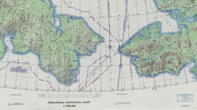
Hydrography, according to the NOAA Office of Coast Survey, “is the science that measures and describes the physical features of bodies of water and the land areas adjacent to those bodies of water.” In other words, hydrography maps the bottom of navigable waters to make sure that ships and boats know what is under them (sorry, they don’t do the work to help you find big bass).

The IHO was started as an attempt among leading coastal nations to develop tools and standards for mapping oceanic features. A primary goal has been to assure the “greatest uniformity in nautical charts and documents,” so navigation is not dependent on differences in techniques, languages or quality of information. The IHO has also led in the development of modern mapping and measurement techniques, including satellite and other remote-sensing methods (but the standard method still involves “multibeam echosounding”—like the thingee on your bass boat). Most of the major maritime nations, 89 at the present, are parties to the international agreement that governs the IHO.
And it’s a big job. In the U.S., NOAA(the national Oceanic and Atmospheric Administration) maintains more than 1,000 nautical charts that cover 3.6 million square nautical miles of U.S. waters and 95,000 miles of shoreline. And because storms, tides, waves, plate tectonics and other natural and human-caused disturbances keep moving the bottom around, NOAA needs to conduct 2,000-3,000 square miles of surveys annually.

The conservation mission of IHO focuses on providing physical descriptions for protected and sensitive marine areas. Accurate, uniform and accessible maps are essential for understanding the relationship between the distribution and abundance of living creatures and the condition of their environments. Because the uses of the ocean are moving to deeper areas farther offshore, improved capacity to understand and monitor deep waters—one of the least understood parts of our earth—becomes increasingly important. And with more development of coastal areas and the specter of sea-level rise and more frequent, stronger storms, the importance of hydrography for public safety also increases.
References:
International Hydrographic Organization. About the IHO. Available at: https://iho.int/en/about-the-iho. Accessed March 5, 2020.
NOAA National Ocean Service. What is hydrography? Available at: https://oceanservice.noaa.gov/facts/hydrography.html. Accessed March 5, 2020.
