The World’s First Wilderness Area Established (1924)

We remember Aldo Leopold as the “father of wildlife conservation,” but we could just as easily recognize him as the father of wilderness.  Leopold’s foresight and vision led him to propose that a new concept—wilderness—be carved out of America’s national lands.

Aldo Leopold loved the rugged ecosystems of the desert southwest (photo by USFS Pacific Southwest Region)

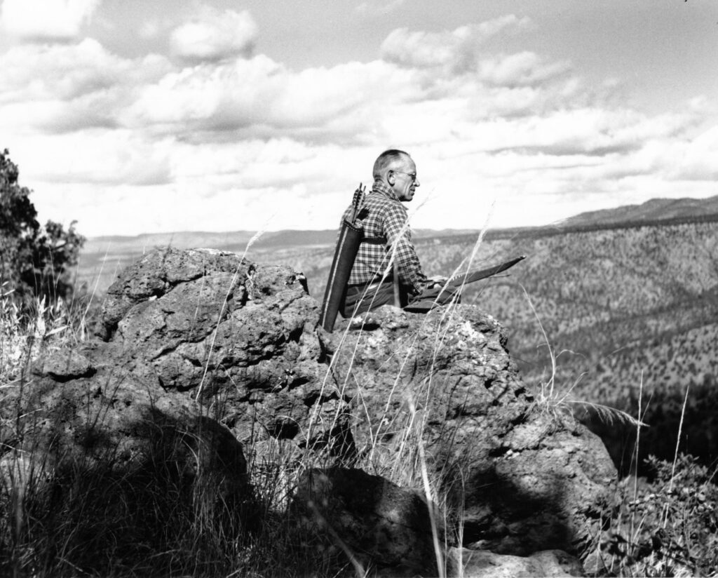
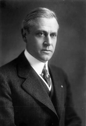
            Aldo Leopold was a forester by training, and his first professional job was on the national forests of New Mexico.  From 1909 to 1924, he worked his way up the ranks, eventually becoming the Chief of Operations for the Albuquerque District of the US Forest Service.  The biggest part of his job was to perform long field observations of the district’s forests, assessing their conditions and making recommendations for improvements (learn more about Leopold here).

            On his field inspections, he observed a troubling trend, “the domestication of the landscape.”  In order to provide for the many uses of national forests, roads were being extended deep into the forests, along with the accompanying power and phone lines, buildings and people.  Even from a recreational perspective, Leopold objected:  “It is just as unwise to devote 100 percent of the recreational resources of our public parks and forests to motorists as it would be to devote 100 percent of our city parks to merry-go-rounds.”

The Gila Wilderness within the Gila National Forest (photo by Obiwannm)

            Instead, he believed a portion of the landscape should be left without human development.  Undeveloped land was a storehouse for natural diversity, providing knowledge about ecological processes and habitat for wild species that didn’t fare well around humans.  Wilderness, he argued, was also a “product” of the forest, just as were trees and hunted game.  Leopold had written the first professional article about wilderness areas in 1921, and three years later he proposed to his supervisors that the Forest Service act on that idea.

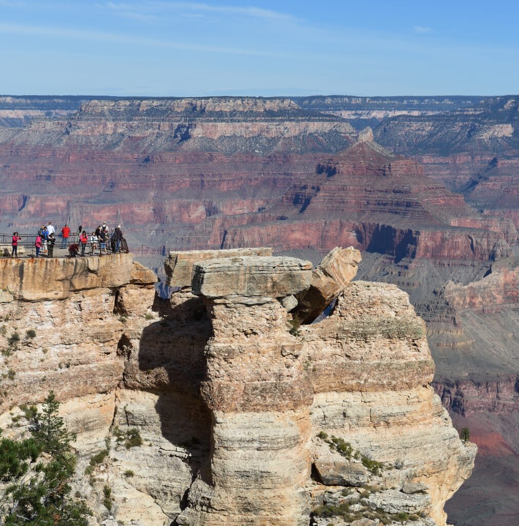
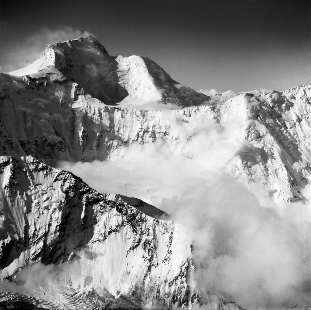
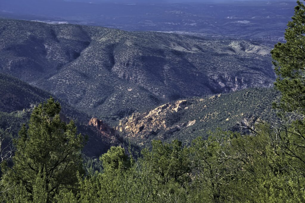
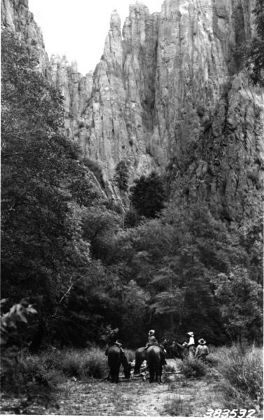
            And he knew the perfect place—the Gila National Forest.  The sprawling forest in western New Mexico had been impacted less than other forests because of its imposing terrain.  In the Gila, the Rocky and Sierra Madre Mountains meet, forming a complex mix of forested mountains, mesas and canyons linked by broad grasslands and deserts.  The district forester agreed, and on June 3, 1924, he signed the Gila Wilderness Area into existence—the first such designation in the world.

Horse riders enjoy the Gila Wilderness in 1922 (photo by USFS)

            Since then, of course, many more wilderness areas have been created—today the U.S. has 803 wilderness areas covering over 111 million acres (about 4.5% of the country).  The Gila is the largest in New Mexico, covering about 560,000 acres.  The Aldo Leopold Wilderness Area is adjacent to the Gila on the East, adding another 200,000 acres to form a contiguous area as large as Rhode Island.  All wilderness areas are now protected under The Wilderness Act, passed in 1964 (learn more about the Wilderness Act here).  Wilderness areas are managed by the land management agency in whose lands they lie—the National Park Service, Bureau of Land Management, U.S. Fish and Wildlife Service or U.S. Forest Service.

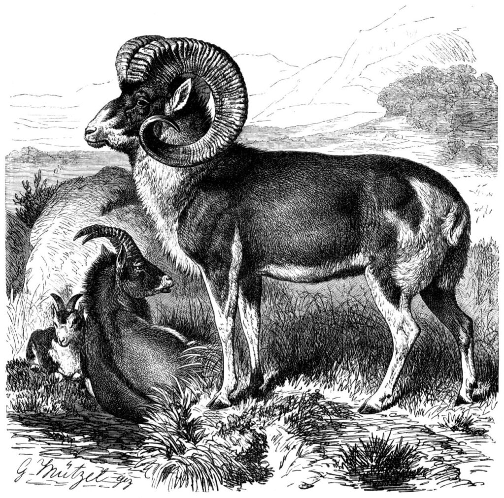
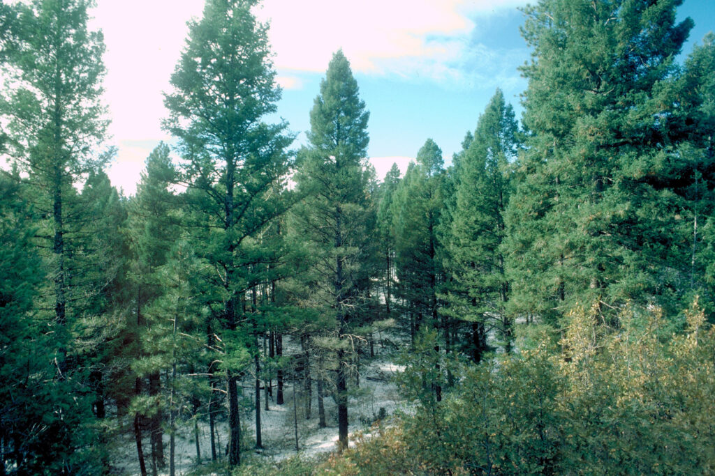
            The Gila is a nature lover’s paradise.  It is a crossroads of ecosystems, with an expansive biodiversity. The forests range from pinion-pine-juniper stands on the east to ponderosa pine in the central portion and spruce-fir areas on the higher-elevation west.  The fauna ranges from elk to Gila monsters, and several packs of re-introduced Mexican wolves call the Gila home.  As Tim Gibbons wrote, on the Gila “you can hook a catfish on one cast and the endemic Gila trout on another.”  Trails wind 800 miles through the landscape (not sure Leopold would like that), but are accessible only on foot or horseback.

            So, not only must be thank Aldo Leopold for the conservation philosophy he wrote in Sand County Almanac and the technical ideas he developed for wildlife management, but also for starting us on the path to preserving wilderness.  Bravo, Aldo!

References:

Gibbons, Tim.  2014.  An American Original:  Aldo Leopold in the Gila Wilderness.  Your National Forests Magazine, Summer/Fall 2014.  Available at:  https://www.nationalforests.org/our-forests/your-national-forests-magazine/aldo-leopold-in-the-gila-wilderness. Accessed March 13, 2020.

Nielsen, Larry A.  2017.  Nature’s Allies – 8 Conservationists Who Changed Our World.  Island Press, Washington, DC.  255 pages.

US Forest Service.  History of the Gila Wilderness.  Available at:  https://www.fs.usda.gov/detail/gila/learning/history-culture/?cid=stelprdb5038907. Accessed March 13, 2020.

Wilderness Connect.  Gila Wilderness; and Fast Facts.  Available at:  https://wilderness.net/visit-wilderness/?ID=205.  Accessed March 13, 2020.

Stephen Mather, Founding Director of the National Park Service, Born (1867)

How fitting it is that the man who led the creation of our great National Park Service should have been born on the 4th of July.  Often called “America’s Best Idea,” the national parks of the United States have become a symbol of what democracy and freedom mean to a nation’s people.  And we have Stephen Mather to thank for it.

Stephen Mather in 1916 (photo by Marian Albright Schenk)

            Stephen Tyng Mather was born on July 4, 1867 in San Francisco (died 1930) to a prominent family.  He attended the University of California at Berkeley, graduating in 1887, and then became a reporter for the New York Sun.  He later joined his father, working for a New York company that manufactured borax, a salt of the element boron and an important ingredient in detergents.  Mather was charged with promoting his company’s rather routine product.  To do so, he developed an advertising campaign around the name, “20 Mule Team Borax,” which became one of the most recognizable brands in America (ask your grandparents).  Mather left that company and formed his own borax-manufacturing firm, becoming a wealthy millionaire as a result.

            Mather was a model of American success.  One admirer described him as “a figure larger than life—tall, blue eyed, ally of avant-garde poetry, a man of ‘colossal popularity’ in the business world, an ‘alloy of drive and amiability.’”  But he also suffered from recurring bouts of depression, so severe that he sometimes required hospitalization.  Mather had one reliable antidote for his depression—immersion into nature. He especially loved the country’s few western national parks, Yosemite and Sequoia in particular. 

Mather Point in Grand Canyon National Park (photo by Tim Adams)

            On a visit to those two parks in 1914, he was appalled by their condition.  The parks were basically unmanaged, with no professional staff, shabby development and illegal use by miners, loggers and cattlemen.  He wrote to the Secretary of Interior, a friend from college, complaining about what he saw.  The Secretary wrote back, “If you don’t like the way the national parks are run, why don’t you come… and run them yourself.”

            Mather did as asked, retiring from business and moving to Washington for a planned one-year stint as an unpaid leader of the national parks.  He lasted for 25 years, becoming the first director of the National Park Service when formed in 1916.  Through his genius, vision and hard work, he led the transformation of the parks into the treasure we know today.  People liked him, listened to him, believed in him.  In 1915, he conducted the “Mather Mountain Party” tour to several western parks; his guests included business leaders, elected politicians, scientists and the editor of National Geographic (learn more about National Geographic here)   One later said, “If [Mather] was out to make a convert, the subject never knew what hit him.”

NPS Director Stephen T. Mather riding in a motorcycle sidecar in Yellowstone National Park (photo by NP Gallery)

            Mather fostered the legislation that formed the National Park Service in 1916 and then used his position as founding director to protect and enhance the parks.  The 13 existing national parks and 18 national monuments were united under one agency, and each was assigned professional staff.  Mather knew that the parks would succeed only if the public loved them, so he commissioned roads and comfortable lodging for the growing trend of automobile vacations.  He developed policies that protected the scenic beauty of parks while also making their grandeur accessible to the public.  He expanded the park idea into the eastern U.S., adding Shenandoah , Great Smoky Mountain (learn more about this park here), and Mammoth Cave National Parks.  When money ran out, he paid from his own pocket, spending more than $250,000 over his term (at a time when the entire agency budget was $20,000 a year).

Your host with the Stephen Mather plaque in Rocky Mountain National Park (photo by Sharon Nielsen)

            Although John Muir is remembered as father of the national parks (learn more about Muir here), Stephen Mather might be called their favorite uncle—adding discipline when needed but being great fun the rest of the time.  Mather’s contributions are recorded in a small plaque displayed at most national parks today.  It tells his story well:  “He laid the foundation of the National Park Service, defining and establishing the policies under which its areas shall be developed and conserved unimpaired for future generations.  There will never come an end to the good that he has done.”

References:

American Academy for Park & Recreation Administration.  Stephen Tyng Mather.  Available at:  https://www.aapra.org/pugsley-bios/stephen-tyng-mather.  Accessed March 13, 2020. 

Public Broadcasting System.  Stephen Mather (1867-1930).  Available at:  https://www.pbs.org/nationalparks/people/nps/mather/. Accessed March 13, 2020. 

Schultz, Eric B.  2019.  Preservation and Entrepreneurship:  The Ongoing Impact of Stephen Tyng Mather.  Gettysburg Foundation, September 16, 2019.  Available at:  https://www.gettysburgfoundation.org/gettysburg-revisited/blog-reimagining-gettysburg/preservation-and-entrepreneurship. Accessed March 13, 2020. 

Swift, William.  Stephen T. Mather.  National Park Service:  The First 75 Years.  Available at:  https://www.nps.gov/parkhistory/online_books/sontag/mather.htm. Accessed March 13, 2020. 

Great Auk Went Extinct (1844)

If you were looking for a poster illustration of how species go extinct, you could stop your search right here at the Great Auk.  This large, flightless bird of the North Atlantic had no chance of survival as a new and lethal force entered its environment—humans.

            We have few details about the ecology of the Great Auk (Pinguinus impennis) , but what we do know foretells a tragic story.  Early sailors called them penguins (although they aren’t), and they share several life-history traits with penguins.  Great Auks evolved to be big—about 2 feet tall and weighing about 10 pounds, too big to fly.  Like penguins, Great Auks were clumsy on land.  But they were excellent swimmers, using their shortened wings as fins to propel them in pursuit of fish.  They stayed in the water except for breeding, when they came ashore in large colonies to lay, brood and hatch a single egg per female.  The colonies stretched across the North Atlantic, from the waters off Great Britain all the way around to the Canadian maritime provinces.

The Great Auk, by John James Audubon

            Great Auks numbered in the millions until the trouble began.  In the last “little ice age” (circa 1500-1800), sea ice linked their breeding islands together with larger land areas.  That gave polar bears access to Great Auk breeding grounds, increasing natural predation on the birds.  But the big change came as fishing and sailing traffic across the North Atlantic increased.  Humans quickly learned that the Great Auk was, forgive the ornithologically inaccurate pun, a sitting duck.  The dense flocks on breeding islands were exploited easily; one sailor reported that the birds were so thick “that a man could not put his foot between them.”  Another sailor noted that harvesting the defenseless birds was as effortless as collecting stones. The birds provided eggs and meat for sailors, bait for fishing, feathers for pillows, and even fuel—the oil-rich carcasses could be burned when other fuels ran low. 

Great Auk specimen and egg in the Glasgow, Scotland, museum (photo by amanderson2)

            By the mid-1800s, hunting had made the birds scarce.  Breeding colonies had been destroyed on many smaller islands, leaving only a few larger colonies extant.  As numbers dwindled, collectors became the next threat.  One specimen of an adult bird or an egg could bring $16, the equivalent then of a year’s wage for a skilled worker.  About 80 specimens remain in museums and private collections today.

            The last major colony of Great Auks bred on an Icleandic island called Geirfuglasker, which means “Great Auk Rock.”  Nature destroyed that colony in 1830 when the island sunk after a volcanic eruption.  Five years later, however, a few birds were found on nearby Eldey, a tiny island of about 10 acres.  Museums and private collectors quickly targeted the island.  A trio of collectors caught and killed the last pair of Great Auks on July 3, 1844.  In the process, they also accidentally crushed the last egg.

( The story requires a little caveat. Sources differ on exactly when those last two birds were captured and killed.  Modern websites generally agree on July 4, 1844.  But older sources state that the probable date of extinction was in June, not July, and anywhere from the 2nd to the 5th.  Alfred Newton, an early professor of zoology at Cambridge University and an expert on the Great Auk, interviewed the collectors some years after their return; he likes July 3rd.  But, as other observers have said, sailors are not particularly good with dates—so, you pick!)

            The story of the Great Auk joins with several others—the Passenger Pigeon, for example—that demonstrate what can happen when extinction’s perfect storm occurs (learn more about the Passenger Pigeon here).  When a species has an innately risky life history, has great value to humans, and can’t defend itself, tragedy is the likely outcome. 

References:

Cornell Lab of Ornithology.  Great Auk.  Available at:  https://birdsna.org/Species-Account/bna/species/greauk/introduction. Accessed March 12, 2020.

Giaimo, Cara.  2019.  Why the Great Auk Is Gone for Good.  The New York Times, Dec. 4, 2019.  Available at:  https://www.nytimes.com/2019/12/04/science/great-auks-extinction.html. Accessed March 12, 2020.

Galasso, Samantha.  2014.  When the Last of the Great Auks Died, It Was by the Crush of a Fisherman’s Boot.  Smithsonian Magazine, July 10, 2014.  Available at:  https://www.smithsonianmag.com/smithsonian-institution/with-crush-fisherman-boot-the-last-great-auks-died-180951982/. Accessed March 12, 2020.

John James Audubon Center at Mill Grove.  The extinction of The Great Auk.  Available at:  https://johnjames.audubon.org/extinction-great-auk. Accessed March 12, 2020.

National Geographic.  Jul 3, 1844 CE:  Great Auks Become Extinct.  Available at:  https://www.nationalgeographic.org/thisday/jul3/great-auks-become-extinct/.  Accessed March 12, 2020.

U.S. Fish and Wildlife Service Created (1940)

The United States government had been conserving fisheries and wildlife for a long time, through the gradual accumulation of individual programs and offices.  But on June 30, 1940, the two primary agencies were married—a union that has lasted for 80 years and led the dramatic return of much of our native wildlife.

            The marriage had a long courtship.  Federal fisheries management began officially in 1871, when Congress created the Fish Commission to oversee the rebuilding of depleted marine fisheries; eventually the Fish Commission became the Bureau of Fisheries within the Department of Commerce.  Federal wildlife management began officially 14 years later, in 1885, when the US Department of Agriculture created the Section of Economic Ornithology, addressing the relationship of birds and farming.  A year later mammals were added to the charge and the agency was eventually renamed the Bureau of Biological Survey. 

            These two agencies, working separately and in two different cabinet departments (Commerce and Agriculture) carried the nation’s primary responsibility for all matters concerned with fisheries and wildlife.  President Franklin Roosevelt didn’t like the arrangement, so in 1939, he moved the two into the Department of the Interior, with this logic:

“These two Bureaus have to do with conservation and utilization of the wildlife resources of the country, terrestrial and aquatic. Therefore, they should be grouped under the same departmental administration, and in that Department which, more than any other, is directly responsible for the administration and conservation of the public domain.”

But that wasn’t enough.  The next year, on June 30, Congress and the President agreed on another reorganization that married the two as one comprehensive agency—the U.S. Fish and Wildlife Service (USFWS).  Roosevelt further reasoned that “[t]he natural areas of operation of these two bureaus frequently coincide, and their activities are interrelated and similar in character. Consolidation will eliminate duplication of work, facilitate coordination of programs, and improve service to the public.”

Lake sturgeon are raised at the Edenton, NC National Fish Hatchery (photo by USFWS Southeast Region)

            Several later reorganizations have occurred (the most important was the removal of commercial and marine fisheries management back to the Department of Commerce), but the USFWS has remained mostly stable since 1940.  It now operates through a Washington, DC, headquarters, 8 regional offices, and field offices distributed across the country.  The USFWS employs about 9,000 people supported by about $2.7 billion in appropriations, both discretionary and mandatory.

            The programs of the agency have expanded over the years as concerns for fisheries and wildlife resources have evolved.  The USFWS states that its mission is to “work with others to conserve, protect and enhance fish, wildlife and plants and their habitats for the continuing benefit of the American people.”  The agency address that mission through these major programmatic areas:

American Avocets at a Utah national wildlife refuge (photo by USFWS Headquarters)
  • Operation of the National Wildlife Refuge System, which contains 568 refuges, 38 wetland districts and 5 marine national monuments covering 95 million acres of lands and 760 million acres of submerged lands and waters;
  • Restoration of fish and wildlife populations and their habitats, including both hunted and non-hunted (or non-game) species and raising fish in 70 national fish hatcheries;
  • Protection of threatened and endangered species, primarily through the Endangered Species Act (however, marine and anadromous species are protected by the National Marine Fisheries Service in the Department of Commerce);
  • Management of migratory birds, including hunting quotas throughout the U.S, laws and treaties that cover birds that migrate internationally, and the Duck Stamp program (Duck Stamps are basically licenses that must be purchased by all hunters of migratory birds);
  • Leadership of the U.S. role in international conservation, including treaties and other agreements with nations of the world, such as the Convention on International Trade of Endangered Species (CITES);
  • Enforcement of all federal wildlife laws, such as the Lacey Act (that prohibits interstate trade in wild species); and
  • Management of federal excise tax programs that provide funding to states and territories for fisheries and wildlife restoration, known commonly as the Dingell-Johnson and Pittman-Robertson Acts.

The job of the U.S. Fish and Wildlife Service is a big one, and it gains in importance with each passing year.  The successes of the agency—many of which have been described on other pages in this website—have produced the bountiful resources that we enjoy today, from self-sustaining wolf populations to resurgent Wild Turkey populations.  May they remain happily married and in love—with nature—for another 80!

References:

Crafton, R. Eliot.  2018.  U.S. Fish and Wildlife Service:  An Overview.  Congressional Research Service, July 20, 2018.  Available at:  https://crsreports.congress.gov/product/pdf/R/R45265.  Accessed March 11, 2020.

Natonal Archives.  Records of the U.S. Fish and Wildlife Service.  Available at:  https://www.archives.gov/research/guide-fed-records/groups/022.html#22.1. Accessed March 11, 2020.

U.S. Fish and Wildlife Service.  About the U.S. Fish and Wildlife Service.  Available at:  https://www.fws.gov/help/about_us.html. Accessed March 11, 2020. U.S. Fish and Wildlife Service.  Public Lands and Waters, National Wildlife Refuge System.  Available at:  https://www.fws.gov/refuges/about/public-lands-waters/index.html. Accessed March 11, 2020.

Mesa Verde National Park Created (1906)

On June 29, 1906, President Theodore Roosevelt signed the law that created Mesa Verde National Park.  It was the sixth national park created, but the first established to “provide specifically for the preservation from injury or spoliation of the ruins and other works and relics of prehistoric or primitive man….”

Cliff Palace of the cliff dwellings at Mesa Verde National Park, circa 1900 (photo by National Park Service)

            Mesa Verde was the right place to begin the mission of preserving the nation’s prehistory.  The region had been occupied for nearly a millennium, until about 1300, by a civilization of pueblo-building Native Americans.  First living on top of the mesa, the inhabitants later moved to the cliff-sides, building into shallow caves the massive adobe structures that we visit today.  Archeologists have found more than 5,000 ancient sites, including relics of farms, irrigation systems and ceremonial areas as well as living structures.  The global significance of Mesa Verde was recognized in 1978, when it became one of the eight original UNESCO World Heritage Sites.

Elk in Mesa Verde National Park (photo by MARELBU)

            The park is relatively small as national parks go, covering just over 50,000 acres.  Along with the ancient sites, the park includes 8,500 acres of federally designated wilderness.  Mesa Verde itself is a high plateau, covered with pine forests that earn it the name of “green table.”  Because of the large range in elevation between the top of the mesa and the canyons below it, the park contains four different vegetative ecosystems.  It is prone to wildfires, and major blazes in the early 2000s burned about half of the park.  Fortunately, because the major archeological sites are on cliff-sides, they have not been affected by recent fires.

            But the real attractions are the pueblos.  From 27 visitors who came in the park’s first year of 1906, annual visitation has risen to over 500,000.  The first scientist to explore the park was Swedish archeologist Gustaf Nordenskjold, who wrote in his 1893 book, The Cliff Dwellers of the Mesa Verde:

“On account of their sheltered position not only the stone walls, but also in many cases the beams that support the floors between the different stories, are wonderfully well preserved.  …we find still in a wonderful state of preservation the household articles and other implements once used by the inhabitants of the cliff-dwellings.  Even wooden articles, textile fabrics, bone implements, and the like are often exceedingly well preserved, although they have probably lain in the earth for more than five centuries.”

1941 photo of ruins in Mesa Verde by Ansel Adams (photo in National Archives)

Before the park was created, collectors removed most of those household articles, but, fortunately, the dwellings themselves still exist and many artifacts are now in museums.  Many human and burial remains that had been removed have now been re-buried, in respect to the 24 Native American tribes that are associated with the site.

References:

National Park Service.  Mesa Verde Administrative History.  Available at:  http://npshistory.com/publications/meve/adhi/contents.htm. Accessed June 28, 2017.

National Park Service.  Mesa Verde National Park Timeline.  Available at:  http://www.visitmesaverde.com/media/399911/mesa-verde-national-park_timeline.pdf. Accessed June 28, 2017.

National Park Service.  The 24 associated tribes of Mesa Verde.  Available at:  http://www.visitmesaverde.com/media/399909/mesa-verde-associated-tribes.pdf. Accessed June 28, 2017.

Nordenskjold, Gustaf.  1893.  The Cliff Dwellers of the Mesa Verde.  Mesa Verde Museum Association, translated from Swedish by D. Lloyd Morgan.  P.A. Nordstedt & Sons, Chicago.  Available at:  https://books.google.com/books/about/The_Cliff_Dwellers_of_the_Mesa_Verde.html?id=dq9xAAAAMAAJ&printsec=frontcover&source=kp_read_button#v=onepage&q&f=false. Accessed June 28, 2017.

UNESCO.  Mesa Verde National Park.  Available at:  http://whc.unesco.org/en/list/27. Accessed June 28, 2017.

US Federal Register.  An Act Creating the Mesa Verde National Park.  Chapter 3607, Fifty-Ninth Congress, 1906.  Available at:  https://www.loc.gov/law/help/statutes-at-large/59th-congress/session-1/c59s1ch3607.pdf. Accessed June 28, 2017.

Mark Shand, Asian Elephant Conservationist, Born (1951)

British conservationist and playboy Mark Shand was born on June 28, 1951 (died in 2014).  After an early life of adventure and high-living, Shand committed himself to the conservation of Asian elephants in India. 

            Mark Shand was born into a privileged family in England; his sister is Camilla Parker Bowles, Duchess of Cornwall and wife of Charles, HRH the Prince of Wales.  After being expelled from school for smoking pot, he fell into the 1960s hedonistic culture—Andy Warhol’s Studio 54 was one of his favorite haunts. He has been described as a “real-life Indiana Jones, whose rugged good looks and charm proved irresistible….”  That charm led to a series of romances with some of the world’s best-known celebrities, including Bianca Jagger and Caroline Kennedy.

Conservation of the Asian elephant was Mark Shand’s life-work (photo by Basila Morin)

            His cavalier life-style changed on a 1988 trip to India, where he fell in love—with an elephant.  He found Tara laboring for peanuts—literally—and “rescued the beautiful female elephant from a life of begging and misery.”  They bonded immediately, and for the next several years Shand rode Tara on a 1000-mile journey across India—memorialized in his 1992 book, “Travels with My Elephant.”  This book, along with three other travel-adventure volumes, won major literary awards and established Shand as a top-selling author.

            Shand used his notoriety as a writer and a man-about-town to publicize the plight of Asian elephants for more than a quarter century.  In 2002, he founded the non-profit organization Elephant Family, enlisting the aid of his famous relatives and friends to spread awareness and raise funds (Prince Charles and the Duchess of Cornwall are co-presidents of the charity).  Shand’s often-stated principle was, “Save the elephants and then you save the forest—and then you save yourself.”

            Asian elephant survival is, indeed, in jeopardy.  IUCN lists the species as endangered, noting that its formerly widespread populations have probably been declining for centuries to today’s critically small numbers.  No more than 50,000 still exist in the wild.  The major threat to their existence is habitat loss, as the human population of the India sub-continent continues to grow and occupy more land.  Today, the available habitat for Asian elephants is only 5% of their original range.

Shand lobbied hard that elephant populations living in isolated preserves were unsustainable.  They required habitat corridors so individuals and families could function as larger connected groups.  He led a successful effort to create a dedicated habitat corridor in the southern Indian state of Kerala.  Several other corridors connecting elephant populations have since been completed, with many more planned.

The Duchess of Cornwall remarked on the occasion of her brother’s death in 2014:  “They say that elephants never forget; Tara never forgot him and neither will we.”

References:

Elephant Family.  Protecting Asian elephants and their habitat.  Available at:  http://elephant-family.org/. Accessed June 29, 2017.

IUCN.  2017.  Elephas maximus.  IUCN Red List.  Available at:  http://www.iucnredlist.org/details/7140/0. Accessed June 29, 2017.

Keleny, Anne.  2014.  Mark Shand:  Campaigner whose efforts to save the Asian elephant took him far beyond the privileged circles from which he came.  The Independent, April 24, 2014.  Available at:  http://www.independent.co.uk/news/obituaries/mark-shand-campaigner-whose-efforts-to-save-the-asian-elephant-took-him-far-beyond-the-privileged-9284764.html. Accessed June 29, 2017.

Lee, Adrian.  2014.  The crazy life of Camilla’s playboy brother Mark Shand.  The Express, April 25, 2014.  Available at:  http://www.express.co.uk/news/royal/472310/The-crazy-life-of-Camilla-s-playboy-brother-Mark-Shand. Accessed June 29, 2017.

Sanctuary Asia.  2011.  Right of Passage:  Elephant Corridors of India.  Sanctuary Asia, April 2001.  Available at:  http://www.sanctuaryasia.com/magazines/cover-story/6830-right-of-passage-elephant-corridors-of-india.html. Accessed June 29, 2017.

The Prince of Wales and The Duchess of Cornwall.  2014.  Times article by The Duchess of Cornwall on her brother, Mark Shand.  September 14, 2014.  Available at:  https://www.princeofwales.gov.uk/media/press-releases/times-article-the-duchess-of-cornwall-her-brother-mark-shand. Accessed June 29, 2017.

United Nations Chartered (1945)

The Charter establishing the United Nations was signed on June 26, 1945, at a meeting of the world’s nations in San Francisco, California.  President Truman signed on behalf of the United States and, just six weeks later, on August 8, 1945, he signed the legislation ratifying the U.S. commitment to the UN—the first country to do so. 

The iconic UN Headquarters building in Manhattan, New York (photo by Larry Nielsen)

            Why is the creation of the United Nations listed in a calendar of significant events in conservation and environmental matters?  Over its 70+ year history, the United Nations has grown to encompass a vast network of treaties, conventions and organizations focused on sustaining nature.

            The UN is most familiar to us as a global political organization.  It operates out of an iconic campus in New York City.  There the General Assembly meets to make decisions in support of world peace.  Many people disparage the UN’s ability to help—but we have not experienced a world war since its creation.

            The UN Charter lists the purposes and rationale for the creation of this splendid international organization.  The organizations was founded “to save succeeding generations from the scourge of war…”—meaning, specifically, the scourge of the two world wars of the 20th Century.  But it also was created “to promote social progress and better standards of life in larger freedom.”

A statue at UN Headquarters in New York demonstrates the organization’s mission to stop war and violence (photo by Larry Nielsen)

            The later rationale is where UN work on the environment and nature come in.  The main structure of the UN includes “programmes” (the UN uses English English spelling, not American!) and “funds” to address specific issues.  For the environment, these include three primary groups:

  • UN Development Programme, incorporating sustainability as a fundamental element of economic and social development (headquartered in New York);
  • UN Population Fund, which works to control human population growth (headquartered in New York);
  • UN Environment Programme, working “to promote the wise use and sustainable development of the global environment” (headquartered in Nairobi).

The UN also includes a number of “specialized agencies” which are independent organizations under the general UN umbrella.  For the environment and natural resources, these include the

  • UN Educational, Scientific and Cultural Organization (UNESCO), which protects historical, cultural and natural sites around the world (headquartered in Paris);
  • Food and Agriculture Organization (FAO), which fights hunger, not only through traditional agriculture but also through fisheries and forestry (headquartered in Rome);
  • UN World Tourism Organization (UNWTO), which promotes sustainable, accessible and responsible tourism (headquartered in Madrid).
The UN coordinates worldwide efforts to achieve the 17 Sustainable Development Goals (photo by Larry Nielsen)

The UN also coordinates a large series of international conventions and treaties that promote global collaboration and standards on important environmental matters.  The UN website lists 17 treaties on the environment, from climate to pesticides to whales and 9 treaties relating to the law of the sea.

The UN is also home to the coordinated development activities first conducted as the Millennium Development Goals from 2000-2015 and now as the Sustainable Development Goals for 2015-2030.  The17 Sustainable Development Goals include 7 that relate directly to the environment and conservation (clean water and sanitation; affordable and clean energy; sustainable cities and communities; responsible consumption and production; climate action; life below water; and life on land).

Five years after the UN began, President Truman addressed the UN General Assembly.  The points he made are even more valid today than in 1950:

“The United Nations represents the idea of a universal morality, superior to the interests of individual nations. Its foundation does not rest upon power or privilege; it rests upon faith. They rest upon the faith of men in human values–upon the belief that men in every land hold the same high ideals and strive toward the same goals for peace and justice….

I believe the people of the world rely on the United Nations to help them achieve two great purposes. They look to it to help them improve the conditions under which they live. And they rely on it to fulfill their profound longing for peace.

These two purposes are closely interwoven. Without peace, it is impossible to make lasting progress toward a better life for all. Without progress in human welfare, the foundations of peace will be insecure. That is why we can never afford to neglect one of these purposes at the expense of the other.”

References:

US Department of State.  Address by President Harry S. Truman to the UN General Assembly, October 24, 1950.  Available at:  https://2009-2017.state.gov/p/io/potusunga/207324.htm.  Accessed March 10, 2020.

United Nations.  Charter of the United Nations.  Available at:  http://www.un.org/en/charter-united-nations/.  Accessed June 28, 2017.

United Nations.  Sustainable Development Goals.  Available at:  https://sustainabledevelopment.un.org/.  Accessed March 10, 2020.

United Nations.   Treaty Collection.  Available at:  https://treaties.un.org/pages/Treaties.aspx?id=10&subid=A&clang=_en.  Accessed June 28, 2017.

United Nations.  Funds, Programmes, Specialized Agencies and Others.  Available at:  http://www.un.org/en/sections/about-un/funds-programmes-specialized-agencies-and-others/.  Accessed June 28, 2017.

Tajik National Park Added to World Heritage List (2013)

The 2013 annual meeting of the UNESCO World Heritage Program ended on June 27, the date on which I consider the formal decisions of the meeting occurred.  At that meeting, UNESCO added five sites to its World Heritage List.  The five comprise three mountainous ecosystems (Mount Etna, Italy; the Tian Shan mountains, China; Tajik National Park, Tajikistan) and two desert ecosystems (Namib Sand Sea, Namibia; El Pinacate and Gran Desierto de Altar, Mexica).

Ismil Somoni Peak, the highest in Tajik National Park (photo by Jaan Kunnap)

            All are worthy of discussions and exploration—they wouldn’t be World Heritage sites if not—but I’d like to delve more deeply into the Tajik National Park.  Tajik is also known as Mountains of the Pamirs, because the park encompasses that entire mountain range.  Not that it is easy to define a mountain range in that part of the world.  Tajik covers what geographers call the “Pamir Knot,” a tangled mess of mountains that radiate outward from the park.  The mountains are the outcome of collisions between the Indian-Australian and Eurasian tectonic plates.  These mountain ranges are exceptional as the highest in the world, including the Himalayas (where Mt. Everest is) and Karakorum (where K2 is) mountains.  The Pamir Mountains themselves stand just below those two ranges as the third highest mountain range in the world.

Fedchencko Glacier (photo by NASA)

            Tajik was the first national park created in the old USSR, the country that split into pieces—including Tajikistan—at the beginning of the 1990s.  The park is huge, covering 9653 square miles (about the size of Vermont), a whopping 18% of the entire country.  Hardly anyone lives there because it is so remote and the climate is so harsh.  The landscape is mostly high mountains, interspersed with some of the world’s deepest valleys and large treeless plateaus at high elevation.  The highest peak is Ismoil Somoni at 24,590 feet, the 50th tallest in the world (the mountain has had some interesting names—first called Stalin Peak, and then Communism Peak before the current name, after an historical leader). The park is home to scores of glaciers, including the Fedchenko Glacier, the longest (about 30 miles) outside of the polar regions.  More than 170 rivers and 400 lakes complete the ecosystem.

Marco Polo sheep (engarving by Gustave Mutzel, circa 1883)

            Tajik National Park is home to many rare and endangered species.  More than 100 endemic species live there, along with charismatic species of brown bear, snow leopard, Marco Polo Argali sheep,and  Siberian ibex.  UNESCO considers the park to be well protected and of special value because it is so huge and undisturbed by human development.  Unlike most other glaciers, the Fedchenko Glacier is not losing mass because of global warming.  It is covered in thick layers of rock and dirt, which insulate the deeper ice. The park also contains the 47-mile-long Lake Sarez, which was dammed up a century ago when a natural landslide formed the highest natural dam in the world (Uzoi Dam).  In plain terms, there is no place like it in the world!

References:

IUCN.  2013.  Tajikistan gets its first natural World Heritage Site.  21 Jun 2013.  Available at:  https://www.iucn.org/content/tajikistan-gets-its-first-natural-world-heritage-site. Accessed March 9, 2020. 

NASA Earth Observatory.  Stable Fedchenko.  Available at:  https://earthobservatory.nasa.gov/images/84996/stable-fedchenko. Accessed March 9, 2020. 

Natural Heritage Protection Fund.  Tajik National Park.  Available at:  http://www.nhpfund.org/sng/tajik-np.html.  Accessed March 9, 2020. 

UNESCO World Heritage.  Tajik National Park (Mountains of the Pamirs).  Available at:   https://whc.unesco.org/en/list/1252/.  Accessed March 9, 2020. 

World Atlas.  Tajikistan National Park – Mountains of The Pamirs.  Available at:  https://www.worldatlas.com/articles/tajikistan-national-park-mountains-of-the-pamirs.html. Accessed March 9, 2020. 

David Douglas, Pioneering Botanist, Born (1799)

If you’ve ever wondered why a species is named what it is—for example, why is that horse from Mongolia named Przewalski’s horse?—today can solve one of those questions.  Not about Przewalski’s horse, but about the Douglas-fir.

David Douglas (drawing from Curtis’s Botanical Magazine, 1834)

            David Douglas was born in Scotland on June 25, 1799 (died 1834).  As a boy, Douglas loved nature, so when he finished primary school, his father sent him to apprentice with a local gardener.  The work proved successful, and soon Douglas had landed a position with the Botanical Gardens in Glasgow.  His boss there was a famous botanist, William Hooker, who saw the potential in Douglas—Hooker said that Douglas showed “great activity, singular abstemiousness and energetic zeal.”  He got Douglas a job with the Horticulture Society of London as a plant collector for the expeditions that were occurring around the globe; his task was to discover interesting species that could have value back in England—especially oaks, fruit trees and garden plants—and send living specimens back.

            This task consumed the rest of Douglas’ life.  His first voyage had him headed to China, but a diplomatic scuffle between England and China changed the plans.  Instead, in 1823, he collected in the eastern United States and Canada, sending back many varieties of fruit trees and other plants.  His success led to a bigger challenge—in 1825, he joined an excursion of the Hudson’s Bay Company to establish their headquarters at Fort Vancouver on the Columbia River (today’s Vancouver, Washington). 

A stand of Douglas-fir in Washington state (photo by Dave Powell, USDA Forest Service)

            For two years, Douglas roamed the forests of the Pacific Northwest, walking 4,000 miles and usually accompanied only by his dog and a Native American guide.  He returned to England in 1827, but came back for another expedition in 1930, spending three years further exploring in Oregon, Washington, California and, eventually, Hawaii.  During his time as a roving botanist, Douglas described about 250 plants that were unknown in England, sending home specimens of many.  Among them were evergreen species desirable for the lumber trade—Sitka spruce (now the most widely planted lumber species in Europe), sugar pine, western white pine, ponderosa pine, lodgepole pine, Monterey pine and others.  The profusion of new pines was so amazing that Douglas wrote to his mentor, William Hooker, “you will begin to think I manufacture pines at my pleasure.”

Douglas-fir cone (photo by WPF)

            One species of particular importance was named for this exploring botanist, the Douglas-fir (the name is also written as two words, Douglas fir).  For many years, the scientific name of the species also recognized Douglas, but a description was found by an earlier naturalist, so the species was renamed for him, as Pseudotsuga menziesii.  Douglas-firs are among the most common forest trees in the Pacific Northwest, grown and harvested for their many uses, from timber beams to lumber to paper fiber.  The trees can be huge—taller than 300 feet, and more than 11 feet in diameter.  In 1936, Oregon declared the Douglas-fir the state tree, and David Douglas holds a special place in Oregon’s history as botanist and explorer.

            David Douglas lived an adventurer’s life, and he died an adventurer’s death.  When just 34, he was exploring the Mauna Kea volcano on the island of Hawaii.  Wild cattle roamed the landscape, and cattlemen dug large, deep pits to trap unwary cattle.  Douglas traveled with an experienced guide who led him around these pits, but when they reached an elevation where the pits stopped, the guide left Douglas on his own.  Douglas, however, backtracked to lower elevations and fell into a trap.  A bull was already in the trap, or perhaps fell in later.  In either case, when passers-by noticed Douglas’s dog sitting by the edge of the trap, they found Douglas’s mutilated dead body at the bottom of the pit.

            The lesson:  look up at the beautiful trees, but look down once in a while, too.

References:

Discovering Lewis & Clark.  David Douglas (1799-1834).  Available at:  http://www.lewis-clark.org/article/487.  Accessed March 7, 2020.

Lang, Frank A.  David Douglas (1799-1834).  The Oregon Encyclopedia. Available at:  https://oregonencyclopedia.org/articles/douglas_david/#.XmLhSGhKhRY. Accessed March 7, 2020.

Lang, Frank A.  Douglas-fir. The Oregon Encyclopedia.  Available at:  https://oregonencyclopedia.org/articles/douglas_fir/#.XmPS8WhKhRY. Accessed March 7, 2020.

Oregon History Project.  David Douglas.  Available at:  https://oregonhistoryproject.org/articles/biographies/david-douglas-biography/#.XmLjGmhKhRY.  Accessed March 7, 2020.

The Douglas Archives.  David Douglas.  Available at:  http://www.douglashistory.co.uk/history/daviddouglas.htm#.XmPQvmhKhRY.  Accessed March 7, 2020.

Antarctic Treaty Implemented (1961)

Ask any fifth-grader to name the seven continents, and you’ll get the right answer, including Antarctica as one of the seventh.  But Antarctica is different than the other six.  Antarctica belongs to all of the world’s people, but can be used only certain ways.  The Antarctic Treaty, which entered into force on June 23, 1961, governs how the world treats this very special place. 

Antarctica is the huge continent at the “bottom” of the earth (image by Dave Pape)

            The Antarctic Treaty was created as the first post-World War II agreement to limit the spread of arms, particularly nuclear weapons.  It was also a response to seven countries (Argentina, Australia, Chile, France, New Zealand, Norway and the United Kingdom) that claimed sovereignty over some parts of the continent.  Most other nations did not recognize those claims, but awareness rose that a permanent solution was needed to avoid actions (such as mining) on those claims and any new ones.  During 1957-1958, those seven nations plus five more joined together in a global scientific program known as the International Geophysical Year (IGY).  The Antarctic region was a major site for their scientific work.

            Spurred by the success of that venture, the United States led an effort with the other eleven IGY participating nations to prepare a treaty to govern the Antarctic. The treaty was completed on December 1, 1959, followed by its endorsement by the 12 original participants in its drafting; it began operating about 18 months later, on June 23, 1961.  The Antarctic Treaty has provided for a long-term peaceful agreement to maintain the region as a global resource. 

Chinstrap Penguin (photo by Eammon Maguire)

            The treaty has assured that the Antarctic is used exclusively for research and conservation.  Article I states the matter plainly:  “Antarctica shall be used for peaceful purposes only.”  Based on Article I, all research facilities and the information obtained by research studies are open to everyone for inspection and use. 

            An addition to the treaty that entered into force in 1998 (often called the Madrid Protocol) addressed environmental protection more fully.  The addition created a Committee for Environmental Protection to enforce the treaty’s principle that “(t)he Parties commit themselves to the comprehensive protection of the Antarctic environment and dependent and associated ecosystems and hereby designate Antarctica as a natural reserve, devoted to peace and science.”  It includes a framework for protecting the native flora and fauna and prohibits the introduction of non-native species.  It also allows for enhanced protection of special areas with “outstanding environmental, scientific, historic, aesthetic or wilderness values…”

Danco Island, Antarctica (photo by Gary Bembridge)

            The treaty is implemented through a secretariat headquartered in Buenos Aires, Argentina.  It holds an annual meeting of the parties and of the Committee for Environmental Protection, usually during April-June. The list of parties to the treaty has risen to 54 nations, including 29 voting and 25 non-voting members.

References:

Secretariat of the Antarctic Treaty.  The Protocol on Environmental Protection to the Antarctic Treaty.  Available at:  https://www.ats.aq/e/protocol.html.  Accessed March 5, 2020.

Secretariat of the Antarctic Treaty.  2016.  25 Years of the Protocol on Environmental Protection to the Antarctic Treaty.  Available at:  https://documents.ats.aq/atcm39/ww/atcm39_ww007_e.pdf.  Accessed March 5, 2020.

U.S. Department of State.  Antarctic Region.  Available at:  https://www.state.gov/key-topics-office-of-ocean-and-polar-affairs/antarctic/.  Accessed March 5, 2020.

This Month in Conservation

April 1
Wangari Maathai, Kenyan Conservationist, Born (1940)
April 2
Maria Sibylla Merian, German Entomologist, Born (1647)
April 3
Jane Goodall, Chimpanzee Researcher, Born (1934)
April 4
“The Good Life” Begins Airing (1975)
April 5
Civilian Conservation Corps (CCC) Created (1933)
April 6
American Museum of Natural History Founded (1869)
April 7
World Health Day
April 8
A Tribute to the Endangered Species Act
April 9
Jim Fowler, “Wild Kingdom” Co-host, Born (1932)
April 10
Arbor Day First Celebrated (1872)
April 11
Ian Redmond, Primatologist, Born (1954)
April 12
Arches National Monument Created (1929)
April 13
First Elephant Arrives in U.S. (1796)
April 14
Black Sunday Dust Storm (1935)
April 15
Nikolaas Tinbergen, Animal Behaviorist, Born (1907)
April 16
Ling-Ling and Hsing-Hsing Arrive in U.S. (1972)
April 17
Ford Mustang Introduced (1964)
April 18
Natural History Museum, London, Opened (1881)
April 19
E. Lucy Braun, Plant Ecologist, Born (1889)
April 20
Gro Harlem Brundtland, Godmother of Sustainable Development, Born (1939)
April 21
John Muir, Father of American Conservation, Born (1838)
April 22
The First Earth Day (1970)
April 23
World Book Day
April 24
Tomitaro Makino, Father of Japanese Botany, Born (1862)
April 25
Theodore Roosevelt National Park Established (1947)
April 26
John James Audubon Born (1785)
April 27
Soil Conservation Service Created (1935)
April 28
Mexican Gray Wolf Listed as Endangered (1976)
April 28
Chernobyl Nuclear Accident Announced (1986)
April 29
Emmeline Moore, Pioneering Fisheries Scientist, Born (1872)
April 29
Dancing with Nature’s Stars
April 30
First State Hunting License Fee Enacted (1864)
January February March April May June July August September October November December