Cuyahoga River Burst into Flames (1969)

What many people consider the precipitating event of the modern environmental movement occurred on June 22, 1969, when the Cuyahoga River in Cleveland, Ohio, burst into flames.

Fire burning on the surface of the Cuyahoga River in 1952 (photo by Cleveland Press, in the Cleveland State University archives)

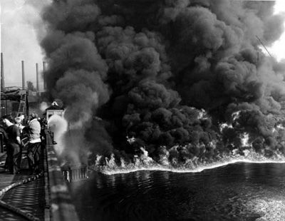
            On that Sunday morning, floating debris, coated in oil, jammed under two railroad bridges that crossed the river.  A spark from a passing train ignited the fire.  Flames shot up as high as 50 feet into the air.  A fireboat on the river quickly extinguished the flames, aided by fire crews working from the trestles.  In a half-hour, the fire was out, causing $50,000 damage to the railroad bridges, but otherwise little noticed.  The Cleveland Plains-Dealer didn’t even run a picture of the blaze.

            But the event was hardly over.  Amidst the growing concern about environmental problems around the country, Time Magazine ran a story on August 1, 1969 (“America’s sewage system and the price of optimism”) that made the Cuyahoga River famous.  “Some river!” the author wrote, “Chocolate-brown, oily, bubbling with subsurface gases, it oozes rather than flows.  ‘Anyone who falls into the Cuyahoga does not drown,’ Cleveland’s citizens joke grimily. ‘He decays.’”

The Cuyahoga River upstream (that is, south) of Cleveland (photo by National Park Service)

            The fire on June 22, however, was nothing new.  A dozen fires on the river had been documented in the previous one hundred years.  A fire in 1912 claimed five lives, and the biggest fire, in 1952, caused more than $1 million in damage.  Photos of the 1952 fire are typically shown when the 1969 fire is discussed—because the 1969 fire was put out so quickly no photographs exist.  In reality, the Cuyahoga River was one of the most polluted in the country at the time of the fire.  The “river that burns” became symbolic of the environmental mess of the country—and especially industrial towns like those in Ohio.  It earned Cleveland the unfortunate nickname of “the mistake by the lake”; Randy Newman’s song “Burn on, Big River,” immortalized the situation; and, even today, the Great Lakes Brewing Company produces Burning River Pale Ale to commemorate the event .

            Ironically, the fire on June 22 should be recognized as the start of good things for the river.  With at least a dozen precursors, the fire was the last, not the first, time the river burned.  We have the burning of the Cuyahoga River to thank for an exclamation point on the growing narrative of environmental awareness of the times. Spurred by this event, the U.S. began passing environmental laws, like the Clean Water Act of 1970 (learn more about the Clean Water Act here).  In the 15 years following the fire, the U.S. instituted a catalog of environmental agencies, laws and regulations that have seen our environment improve dramatically and continually.

The Cuyahoga River has improved greatly since the 1969 fire (photo by k_e_lewis)

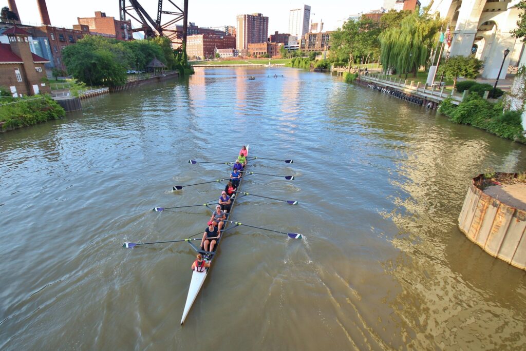
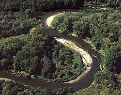
            And the Cuyahoga River has improved right along with the rest.  Forty years after the fire, in 2009, Cleveland celebrated “The Year of the River.”  From no life present in the river at the time of the fire, it now boasts more than 40 fish species including several—steelhead trout, northern pike—that require high-quality water conditions.  Water quality has improved, but is not yet at the levels needed to allow all uses, like swimming.  The Cuyahoga River is one of 43 Great Lakes Areas of Concern, denoted because of remaining environmental problems.  Through the restoration group that monitors the Area of Concern, the river continues to gather the support, from government agencies and local organizations, needed to achieve a fully restored ecosystem.

References:

Cuyahoga River Area of Concern.  Available at:  http://www.cuyahogaaoc.org/index.html. Accessed June 23, 2017.

Time Magazine.  1969.  America’s Sewage System and the Price of Optimism.  Time Magazine, August 1, 1969.  Available at:  http://content.time.com/time/subscriber/article/0,33009,901182-1,00.html. Accessed June 23, 2017.

Cleveland Plain Dealer.  1969.  Oil slick fire damages 2 river spans.  Cleveland Plain Dealer, June 23, 1969.  Available at:  http://blog.cleveland.com/pdextra/2009/01/oil_slick_fire_damages_2_river.html. Accessed June 23, 2017.

Ohio History Central.  Cuyahoga River Fire.  Ohio History Central.  Available at:  http://www.ohiohistorycentral.org/w/Cuyahoga_River_Fire. Accessed June 23, 2017.

Rotman, Michael.  2010.  Cuyahoga River Fire.  Cleveland Historical, September 22, 2010.  Available at:   https://clevelandhistorical.org/items/show/63#.WU0sqWjys2w.  Accessed June 23, 2017.

World Hydrography Day

You know that sonar thingee on your bass boat that you use to find structure where the big ones hang out?  There is a day for that—World Hydrography Day, celebrated annually on June 21.  The date, chosen by the United Nations in 2005, honors the establishment of the International Hydrographic Organization (IHO) on June 21, 1921. 

            Hydrography, according to the NOAA Office of Coast Survey, “is the science that measures and describes the physical features of bodies of water and the land areas adjacent to those bodies of water.”   In other words, hydrography maps the bottom of navigable waters to make sure that ships and boats know what is under them (sorry, they don’t do the work to help you find big bass).

US Navy hdrographers assisting the government of Micronesia to map harbors (photo by US Navy)

            The IHO was started as an attempt among leading coastal nations to develop tools and standards for mapping oceanic features.  A primary goal has been to assure the “greatest uniformity in nautical charts and documents,” so navigation is not dependent on differences in techniques, languages or quality of information.  The IHO has also led in the development of modern mapping and measurement techniques, including satellite and other remote-sensing methods (but the standard method still involves “multibeam echosounding”—like the thingee on your bass boat).  Most of the major maritime nations, 89 at the present, are parties to the international agreement that governs the IHO.

            And it’s a big job.  In the U.S., NOAA(the national Oceanic and Atmospheric Administration) maintains more than 1,000 nautical charts that cover 3.6 million square nautical miles of U.S. waters and 95,000 miles of shoreline.  And because storms, tides, waves, plate tectonics and other natural and human-caused disturbances keep moving the bottom around, NOAA needs to conduct 2,000-3,000 square miles of surveys annually.

Portion of a navigational chart where Russia and Alaska almost touch (photo by US Defense Mapping Agency)

            The conservation mission of IHO focuses on providing physical descriptions for protected and sensitive marine areas.  Accurate, uniform and accessible maps are essential for understanding the relationship between the distribution and abundance of living creatures and the condition of their environments.  Because the uses of the ocean are moving to deeper areas farther offshore, improved capacity to understand and monitor deep waters—one of the least understood parts of our earth—becomes increasingly important.  And with more development of coastal areas and the specter of sea-level rise and more frequent, stronger storms, the importance of hydrography for public safety also increases.

References:

International Hydrographic Organization.  About the IHO.  Available at:  https://iho.int/en/about-the-iho.  Accessed March 5, 2020.

NOAA National Ocean Service.  What is hydrography?  Available at:  https://oceanservice.noaa.gov/facts/hydrography.html.  Accessed March 5, 2020.

David McTaggart, Greenpeace Leader, Born (1932)

The name Greenpeace is today synonymous with the environmental movement.  It evolved from a small organization to an international powerhouse largely because of one man, David McTaggart, through what we might call the perfect storm.

David McTaggart in 1981 (photo by Antonisse, Marcel/Anefo)

            David McTaggart was born in Vancouver, British Columbia, on June 24, 1932 (died 2001).  He was a talented athlete, spending his youth skiing, golfing and playing racquet sports.  He excelled especially at badminton, winning the Canadian national championship three times.  He quit high school to begin a construction business that became highly successful first in Canada, then in the U.S.  However, when an accident on one of his construction sites caused an employee’s serious injury, McTaggart despaired of his role in the matter; he abandoned his business life, sacrificed much of his wealth to compensate for the accident, and left his family to “find out about himself”—the first phase of the perfect storm.

            The storm continued building as he was roaming the South Pacific in his sailboat during 1972.  He answered an ad seeking volunteers to protest French above-ground nuclear tests at the uninhabited atoll, Mururoa.  He was mad, not so much because of the tests themselves, but because of the audacity of the government to declare a portion of the ocean off-limits.  McTaggart renamed his boat the Greenpeace III, after the group that placed the ad, and headed to Mururoa.  He anchored in the path of the expected test plume.  In response, the French navy rammed his boat and towed him to harbor, claiming they had rescued him. The next year, he was back, and the French were more aggressive, boarding his boat and beating him badly.  The government again claimed rescue, but a smuggled film of the altercation added to the storm when it was broadcast. McTaggart successfully sued France, and in 1974, the embarrassed French government halted above-ground testing (and eventually stopped all nuclear testing).

Greenpeace has become an environmental giant, partially because of its aggressive publlicity tactics (photo by Jonathan Happ)

            McTaggart was energized and began building Greenpeace.  Although the organization had several offices in Europe and the U.S., it operated as a loose collection of local groups.  McTaggart united the individual branches into Greenpeace International and led its expansion throughout Europe and North America.  In 1979, he became its president and CEO, roles he retained until retiring in 1991. 

            Under his leadership, Greenpeace became an international juggernaut of environmental action.  He led efforts to protect whales, both through direct confrontations with Japanese whaling vessels, for which Greenpeace has become famous (or perhaps infamous) and through negotiations with the International Whaling Commission, leading to the creation of the Southern Ocean Whale Sanctuary in 1994.  He also led Greenpeace in successful campaigns to establish Antarctic treaties prohibiting mining and to reduce ocean pollution (especially of nuclear wastes).

            McTaggart’s personality and methods did not suit everyone.  He was intensely private as an individual, but intensely confrontational as an environmentalist.  He understood the value of publicity and made sure that all Greenpeace’s actions were filmed and widely shared.  When the organization he had nurtured became too large and staid for his style, Greenpeace and McTaggart went separate ways.

            He moved to the small town of Paciano in central Italy, to farm organic olives.  He created a new organization, the 3rd Millennium Foundation, where he continued his environmental work on a smaller scale, emphasizing local improvements and projects in the Caribbean.  An automobile accident ended his life in 2001.

References:

3rd Millennium Foundation.  About Us—Our History.  Available at:  http://www.3mf.org/about_us/index.html.  Accessed March 3, 2020.

Brown, Paul.  2001.  David McTaggart, Campaigner who led from the front in making Greenpeace a worldwide organization.  The Guardian, 25 Mar 2001.  Available at:  https://www.theguardian.com/news/2001/mar/26/guardianobituaries.paulbrown. Accessed March 3, 2020.

Greenpeace.  David McTaggart 1932-2001.  Available at:  https://wayback.archive-it.org/9650/20191112213722/http://p3-raw.greenpeace.org/international/en/about/history/founders/david-mctaggart/. Accessed March 3, 2020.

Lewis, Paul.  2001.  David McTaggart, a Builder of Greenpeace, Dies at 69.  The New York Times, March 24, 2001.  Available at:  https://www.nytimes.com/2001/03/24/world/david-mctaggart-a-builder-of-greenpeace-dies-at-69.html. Accessed March 3, 2020.

Alexander Wetmore, Ornithologist and Smithsonian Leader, Born (1866)

From his earliest years, Alexander Wetmore knew he wanted to be an ornithologist.  And until his death at the age of 92, he lived up to that expectation.  No wonder he is known as the 20th Century’s “dean of American ornithologists.”

“Alexander Wetmore (photo by Smithsonian Institution)

            Frank Alexander Wetmore was born in a small town in central Wisconsin on June 18, 1886 (died 1978).  When his mother gave him a guide to bird identification at age five, Wetmore was hooked.  He began making serious field notes about birds a few years later, and, when just 13 years old, published his first paper in the magazine Bird Lore—“My experience with a red-headed woodpecker.”

            His experiences with birds grew exponentially.  While a student at the University of Kansas, he began working as an assistant curator in the college’s museum.  During summers he worked for the U.S. Biological Survey in Wyoming and Alaska, and then spent a year studying the birds of Puerto Pico and nearby islands.  After graduation in 1912, he worked full-time for the US Biological Survey (now the US Fish and Wildlife Service), performing fieldwork on birds throughout the Americas and in the Pacific Islands.  While working, he completed M.S. and Ph.D. degrees at George Washington University.

            In 1924, he moved to the Smithsonian Institute, where he stayed for 28 years until his retirement in 1952.  He moved steadily up the ranks into administrative roles; although he disliked administration, he proved good at it—methodical, logical, patient, dauntless. The depression and war years were a tough time for the Smithsonian, plagued by low budgets, insufficient staff, and deteriorating physical facilities.  Wetmore’s rock-solid leadership through those times was valued, resulting in his being named Secretary of the Smithsonian Institution in 1945 .

Wetmore on a collecting trip in Panama (photo by Smithsonian Institution)

            As Secretary, he oversaw substantial changes (although he made them purposefully and conservatively).  He expanded the coverage of the museums, for example, opening an aviation museum that we now know and love as the Air and Space Museum.  He acquired a tropical research station in Panama, now one of the premier biological field stations in the world.  He helped transform the museum’s exhibits from stale to engaging.  He lobbied congress persistently for capital funding that eventually came through—and today we enjoy those labors in the great national museums of the Washington Capitol Mall.

            But it is his work as an ornithologist that has earned him worldwide scientific acclaim.  He never stopped his research, both during his leadership of the Smithsonian and after his retirement in 1952.  He became the world’s foremost expert on fossil birds, basically establishing the field of ornithological paleontology.  He continued field work across the world, but especially in Panama.  He published three of four volumes of his monumental work, The Birds of the Republic of Panama (the fourth volume has been completed in his honor).  His taxonomic work was enormous, naming and describing 189 new bird species and revising bird systematics in his book, A Classification for the Birds of the World.  In all he published more than 700 books and papers.  He donated 26,058 bird and mammal skins, 4,363 anatomical specimens, and 201 groups of bird eggs to the Smithsonian.  His list of awards and recognition seems endless, but the most relevant may be this:  his colleagues have named 56 species of various taxa in his honor.

Wetmore in his later years (photo by USGS)

            He was, as is said of few, a man for all seasons.  The Smithsonian described him as “a quiet and gentle man,… as at home in a remote Panamanian village as the halls of the US Congress.”  His successor at the Smithsonian, S. Dillon Ripley, described him as calm, gentle, meticulous, with total “absence of self-importance.”  May we all be remembered so kindly.

References:

Ripley, S. Dillon and James A Steed.  1987.  Alexander Wetmore, 1886-1978, a Biographical Memoir.  National Academy of Sciences, Washington, DC.  Available at:  http://www.nasonline.org/publications/biographical-memoirs/memoir-pdfs/wetmore-alexander.pdf.  Accessed March 2, 2020.

Smithsonian Institution Archives.  Alexander Wetmore, 1886-1978.  Available at:  https://siarchives.si.edu/history/alexander-wetmore.  Accessed March 2, 2020.

Washington Post.  1978.  Alexander Wetmore, 92, Dies.  December 9, 1978.  Available at:  https://www.washingtonpost.com/archive/local/1978/12/09/alexander-wetmore-92-dies/389d9760-2a3e-459c-bfc0-1491a4ca8443/.  Accessed March 2, 2020.

Great Barrier Reef Protected (1975)

By Royal Assent of the government of Australia, the Great Barrier Reef Marine Park was created on June 20, 1975.  The act stated that its purpose was “to provide for the long term protection and conservation of the environment, biodiversity and heritage values of the Great Barrier Reef Region.”

Giant clam on the Great Barrier Reef (photo by Jandark)

            And it is a “region,” often described as the world’s largest living structure.  The area included in the park is about half the size of Texas, or about the size of Germany.  The reef system stretches along the northeastern coast of Australia for about 1400 miles, making it 8 times longer than the world’s second longest reef (in Belize).  The park itself extends from shore into the sea, up to 150 miles at its widest.  The park specifically also includes the airspace above and the seafloor below the reef itself.

            The size is matched by the amount of biodiversity.  Ecosystems include 3000 coral reefs and about 1000 islands of various origin—land, coral and mangrove.  Those ecosystems are inhabited by an immense variety of species—600 corals, 100 jellyfish, 3000 mollusks, 500 annelids, more than 1700 fish and 30 marine mammals.

Agincourt Reef, Great Barrier Reef (photo by Robert Linsdell)

The park itself is what IUCN calls a “managed resource area.”  Rather than the type of total protection provided by typical U.S. national parks, the Great Barrier Reef is managed in zones.  Some zones are totally protected but others are available for commercial and aboriginal fishing, commercial tourism and as transportation corridors for port cities within the region .

Despite its protected status, the reef has been subject to negative impacts through time.  It is a UNESCO World Heritage Area, but in 2012, a special report by UNESCO indicated that it required more protection to retain that designation.  In response, the Australian government strengthened protection against transportation damage and siltation from poor land use practices on adjacent shore areas.  In 2015, the government announced the elimination of ongoing dredging operations, restriction on new port development and transportation corridors and allocation of $2 billion for restoration and protection.  The Reef 2050 Plan calls for a 50% reduction in sediment loads by 2025.

The coral features on Lizard Island, photographed here in 2014, have now been largely killed by climate change (photo by Ryan McMinds)

Climate change has also affected the Great Barrier Reef.  Long periods of exposure to warm water can kill coral animals, a process known as coral bleaching.  Reefs usually recover from bleaching events, but the recolonization process can take decades.  If warm-water events recur frequently, the damage can become irreversible.  Record high temperatures caused consecutive bleaching events in 2016 and 2017, damaging large areas of the reef.  Estimates suggest that up to one-third of shallow-water corals may have been killed on the northern reef.

References:

Commonwealth of Australia.  2015.  State party report on the state of conservation of the Great Barrier Reef World Heritage Area (Australia).  Available at:  http://www.environment.gov.au/system/files/resources/cb36afd7-7f52-468a-9d69-a6bdd7da156b/files/gbr-state-party-report-2015.pdf. Accessed June 21, 2017.

Commonwealth Consolidated Acts.  Great Barrier Reef Marine Park Act 1975-Sect 2A.  Available at:  http://www.austlii.edu.au/au/legis/cth/consol_act/gbrmpa1975257/s2a.html. Accessed June 21, 2017.

Great Barrier Reef Marine Park Authority.  Facts about the Great Barrier Reef.  Available at:  http://www.gbrmpa.gov.au/about-the-reef/facts-about-the-great-barrier-reef. Accessed June 21, 2017.

Great Barrier Reef Marine Park Authority.  Managing the Reef.  Available at:  http://www.gbrmpa.gov.au/managing-the-reef. Accessed June 21, 2017.

Greening Australia.  Improving the health of the Great Barrier Reef—Reef Aid.  Available at:  https://www.greeningaustralia.org.au/project/Great-Barrier-Reef. Accessed June 21, 2017.

Hoggenboom, Mia.  2016.  How will the Barrier Reef recover from the death of one-third of its northern corals?  The Conversation AU, May 30, 2016.  Available at:  https://theconversation.com/how-will-the-barrier-reef-recover-from-the-death-of-one-third-of-its-northern-corals-60186.  Accessed June 21, 2017.

World Day to Combat Desertification

When the United Nations held the first worldwide conference on environment and sustainable development in Rio during 1992, the assembled leaders recognized that land degradation was a problem needing immediate and global attention.  Two years later, in 1994, the nations of the world came together to create the Convention to Combat Desertification (UNCCD).  And to bring global attention to the issue, they also created an annual day of focus on the day the convention was signed—June 17.

Desertification is the loss of land productivity due to poor land-use practices (photo by Jeanajean)

            Let’s start with the definition of desertification.  It is not the spread of existing deserts due to natural phenomena (so don’t choose that on the multiple-choice exam).  Rather, says the UNCCD, desertification is the “degradation of land in arid, semi-arid and dry sub-humid areas…. It occurs because dryland ecosystems, which cover over one-third of the world’s land area, are extremely vulnerable to overexploitation and inappropriate land use.  Poverty, political instability, deforestation, overgrazing and bad irrigation practices can all undermine the productivity of the land.”

              Desertification happens because humans change the ecosystem to make way for agriculture and cities.  Consider the numbers.  Of the 20% of the earth that is habitable land, half has been modified for agriculture and another bit for cities.  Of those agricultural lands, 77% is used for livestock and 23% for cultivated crops. While much of this agricultural land is sustainable for agriculture, 44% is in dryland ecosystems—areas subject to desertification. 

            Most of this vulnerable land is in Asia and Africa, where the pressure to grow food is high.  The result can be loss of soil fertility due to inappropriate cultivation and irrigation or overgrazing by livestock.  About 5 billion acres of land have been degraded, and 24 billion tons of soil are lost annually.  More than 3 billion humans face lowered quality of life because of desertification.  Soil organic carbon, essential for productive land use, has fallen 8% globally, adding to greenhouse gas emissions.  the economic cost of all this is estimated to be US$300 billion annually.

            The UNCCD, with 197 nations participating, and World Day to Combat Desertification exist to reverse this trend.  The day (which sometimes is broadened to cover desertification and drought) chooses an annual theme that focuses on sustainable land-use practices and public education.  Many positive programs are operating today.  China is creating a new Great Green Wall of China that will include 100 billion trees planted along a 3,000-mile swath of dryland adjacent to the Gobi Desert .  In Africa, nations in the Sahel Region are re-vegetating lands that have been degraded, matching the specific plants and cultivation strategies to the local conditions.  Often, acacia trees are planted in association with other crops, a type of agro-forestry.

Restoration of a dryland forest on Maui (photo by Arthur Medeiros, USGS)

            Like most strategies in ecological restoration, fighting desertification yields other benefits.  Ibrahim Thiaw, leader of UNCCD, said, “By restoring land, we store carbon, and we also restore biodiversity at the same time, while responding to multiple benefits for local communities.”  Land restoration also invests in the local community, providing jobs and improving profits from land-use.  The benefit:cost ratio averages about 10:1, and as much as 80% of the economic investments and benefits stay at home.

References:

Funnell, Antony.  2019.  China and Africa are building ‘ great walls’ of trees to hold back the desert.  But will it work?  ABC Radio National, 16 Oct 2019.  Available at:    https://www.abc.net.au/news/2019-10-17/green-walls-in-china-and-africa-keeping-deserts-at-bay/11602796. Accessed February 29, 2020.

UN Convention to Combat Desertificiation.  Land in Numbers 2019.  Available at :  http://catalogue.unccd.int/1202-Land%20in%20numbers_2%20new-web.pdf. Accessed February 29, 2020.

UN Convention to Combat Desertification.  UNCCD History.  Available at :  https://www.unccd.int/convention/about-convention/unccd-history. Accessed February 29, 2020.

United Nations.  World Day to Combat Desertification and Drought 17 June.  Available at:  https://www.un.org/en/events/desertificationday/.  Accessed February 29, 2020.

Feast of the Forest, Palawan, Philippines

The Palawan Province of the Philippines celebrates June 19 each year as “Feast of the Forest,” a local holiday that recognizes the importance of forests to the province and its commitment to environmental sustainability.

            Palawan Province is a group of long, thin Philippine islands that run southwest from near Manila almost to Borneo in Malaysia.  In geological history, Palawan was connected by land to Borneo, and much of the flora and fauna is more closely related to Borneo than the larger land mass of the Philippines.

Subterranean River National Park in Puerto Princesa, capital city of Palawan Province (photo by Charisma312017)

            In 2001, the government of the Philippines declared the special holiday for the capital city of Puerto Princesa as Feast of the Forest “to generate participation in activities strengthening the province’s commitment to reforest our precious lands and contribute to the global effort of preserving God’s gift of nature for future generations to enjoy.” 

            The nation could not have picked a better place to praise and protect nature.  Palawan is recognized by several travel and tourism sources as the world’s most beautiful island.  Its biodiversity is impressive—thousands of square miles of mangrove forests with 90% of the nation’s known species; of 11 endemic amphibians in the Philippines, 8 are found only there; 279 bird species, 27 of which are endemic, nest there; and much more.  Most impressive are the coral reefs, which contain 379 species, or 82% of all those in the country (learn more about the coral richness of the area here).  Palawan is home to two UNESCO World Heritage Sites—Tubbataha Reef National Park and Puerto Princesa Subterranean River National Park—and is a Man and Biosphere Reserve (learn more about UNESCO here)/.

School of barracuda in Tubbataha Reef National Park (photo by Jun V Lao)

            The main city of Puerto Princesa is equally notable for its commitment to trees and their carbon-capturing ability.  Starting in the 1990s, the city began an aggressive tree-planting program that has continued and grown ever since.  Now known as “The City in the Forest,” Puerto Princesa has adopted the idea of Community Based Forest Management to engage the entire population in the tree-planting effort.  Each year, local groups have planted about 100,000 trees, raising the forested area of the city by about 100,000 acres over a 20-year period.

            The massive increase in growing trees has made Puerto Princesa not only the first carbon-neutral city in the country, but a carbon-negative city!  Trees pull more carbon out of the atmosphere than all the carbon-emitting activities of the city of 220,000 people. Imagine if every medium-sized city in the world did that!

References:

Chan Robles Virtual Law Library.  An Act Delcaring June Nineteenth of Every Year as a Special Working Holiday in the City of Puerto Princesa and the Province of Palawan as Pista U Ang Kagueran.  Republic Act No. 9001, Government of the Philippines.  Available at:  http://www.chanrobles.com/republicactno9001.html#.WUgDluvyupo.  Accessed June 19, 2017.

Jayagoda, Dimithri Devinda.  2015.  A unique case study of tree plantation bringing increased forest cover to Puerto Princesa, Philippines.  Journal of Sustainable Development 8(1):138-155.  Available at:  http://www.ccsenet.org/journal/index.php/jsd/article/viewFile/41442/24405. Accessed June 19, 2017.

Ledbetter, Carly.  2017.  Palawan, the most beautiful island in the world, is sheer perfection.  Huffington Post, February 6, 2017.  Available at:  http://www.huffingtonpost.com/2016/07/07/coron-palawan-philippines_n_6193058.html. Accessed June 19, 2017.

Official Website of the City Government of Puerto Princesa.  Puerto Princesa:  The first carbon neutral city in the country.  Available at:  http://puertoprincesa.ph/?q=about-our-city/puerto-princesa-first-carbon-neutral-city-country. Accessed June 19, 2017.

 Save Palawan Campaign.  Palawan biodiversity facts and figures.  Available at:  https://pnni.wordpress.com/palawan-biodiversity-facts-and-figures/. Accessed June 19, 2017.

Gray Whale Delisted (1994)

One of the great success stories of conservation is the recovery of the eastern North Pacific Ocean population of the gray whale.  It has recovered to its pre-exploitation levels, allowing the U.S. to remove it from the endangered species list.

Gray whale (photo by Marine Mammal Commission)

            The gray whale (Eschrichtius robustus) is a special kind of whale.  It is the only species in its family and is believed to be the most ancient of living whales.  It is a baleen whale, which refers to a series of keratin plates that hang from the roof of its mouth and allow it to filter small organisms in the ocean’s water.  Baleen whales swim through the water with their mouths open, collecting huge amounts of water and organisms; then they partially close their mouths, with the baleen plates forming a filter.  They push the water out, and the food organisms collect on the inside of the baleen plates.  The whales use their massive tongues to scrape the food from the baleen plates and swallow.

            What makes gray whales unique is that they feed on the bottom, rather than in the water column like other baleen whales (blue and right whales, for example).  They dig into the bottom substrate in shallow water, using their snouts or rolling along the bottom, sending clouds of sediment and organisms into the water.  The whales then take in huge mouthfuls of the mixture, spit out the water and muck, and eat what is left.  What fun!

Gray whale breaching; the gray whale has a distinctive appearance because barnacles and marine lice attach themselves to the head and tail of the animals (photo by Merrill Gosho, NOAA)

            Gray whales also make extensive migrations, perhaps the longest among all mammals.  Individuals spend the summer months grazing in the Bering and Chukchi Seas off Alaska and Russia.  As autumn arrives, they migrate south along the Canadian and U.S. Pacific coasts, down to Baja California in Mexico, where females give birth to a single calf.  The total migration is over 10,000 miles per year.

            Whalers nicknamed the species “devilfish” because the whales fought ferociously when harpooned or to protect their calves. Nonetheless, other characteristics made them a desirable target. Because gray whales travel close to shore on their migrations, they have always been vulnerable to hunting.  Individuals are large, but manageable (about 45 feet long and weighing 45 tons) for hunters, both aboriginal and commercial.    Consequently, the gray whale was hunted to near extinction by the 1860s, shrinking from a pre-industrial abundance of about 30,000 to a low of 2,000.

Whale watching is now the primary concern for whale conservation, as the popularity may impact whale behavior (photo by S. Rae)

            Conservation efforts stopped the exploitation.  The gray whales were (and are) protected under the Marine Mammal Protection Act, the International Whaling Commission’s moratorium on commercial whaling (learn more about the IWC here), and listing as an Appendix I species by the Convention on International Trades in Endangered Species (CITES) (learn more about CITES here).  With little hunting mortality, the species has recovered well, growing at about 3% per year and now above 27,000 individuals.  Because this is considered within the normal pre-industrial population range, the eastern population is considered recovered and was removed from the U.S. endangered species list on June 16, 1994.

            The species has two distinct populations, however, and only one—the eastern—is de-listed and recovered.  The western population, which lives in coastal waters of Russia and northern Asia, is nearly extinct, with perhaps as few as 200 individuals remaining; it remains on the U.S. endangered species list.

            Today, the main threat to the gray whale is its popularity (tangling in fishing gear is also a worry).  Because animals travel close to shore and in shallow water, the species is the main target of whale watching excursions.  If whale-watching boats get too close to the whales, follow them for too long or chase them as they swim, the whales can become stressed and exhausted.  Consequently, the U.S. has issued rules for whale watching—prohibiting approach closer than 100 yards and restricting viewing of individuals to no more than 30 minutes.

            We all love whales, of course, but let’s be sure that we don’t love them to death.

References:

CITES.  Proposal from Japan to Transfer Gray Whales to Appendix II.  Available at:  https://www.cites.org/sites/default/files/eng/cop/11/prop/15.pdf.  Accessed February 28, 2020.

NOAA Fisheries.  Gray Whale.  Available at:  https://www.fisheries.noaa.gov/species/gray-whale.  Accessed February 28, 2020.

Save the Whales.  Gray Whale.  https://savethewhales.org/gray-whale/.  Accessed February 28, 2020.

Global Wind Day

Global Wind Day is celebrated around the world annually on June 15.  Begun in 2007 as just Wind Day, it became Global Wind Day in 2009.  The annual event is sponsored by the Global Wind Energy Council, a wind-energy industry association and WindEurope (formerly the European Wind Energy Association), both located in Brussels, Belgium.

            The purpose of Global Wind Day is to promote the use of renewable energy, particularly wind energy.  According to the official website, “it is a day for discovering wind, its power and the possibilities it holds to reshape our energy systems, decarbonize our economies and boost jobs and growth.”

            European leadership of this annual event makes sense because Europe is the global leader in virtually all aspects of this renewable industry.  The European industry employs 300,000 people, generates about $72 billion annually and is one of Europe’s largest exports. Wind energy accounts for 15% of Europe’s electricity supply overall, with Denmark leading among individual countries with 47%.  Denmark’s goal is generate all electricity by renewable sources by 2030, most of which would come from wind turbines.

An offshore wind farm in Denmark (photo by Kim Hansen)

            In 2019, total world supply of wind-generated energy reached 591 gigawatts—enough to power the equivalent of every U.S. household, with a lot left over!  According to the Global Wind Day’s sponsors, on-shore wind energy is today the least expensive type of new electrical power to install.  For that reason, the rate of new installations worldwide continues to grow, with 91 countries around the world using wind to produce electricity.  China leads in new installation, with the U.S. second.  China also has the most installed wind capacity, at 221 gigawatts, or about 37% of the world’s total (but that is only about 2% of China’s total electricity production).  Globally, more than 1 million people work in wind energy.

            The growth of the U.S. wind energy sector is impressive, even if the total energy produced is still small.  The U.S. produces about 105 megawatts of wind capacity as of the end of 2019, or about 6.5% of the country’s total electricity production.  Texas leads all states in production, with more than one-quarter of the nation’s total.  Iowa is second (10%), followed by Kansas and California (both with about 5%). The industry grows at about an 18% annual rate, tripling in the last decade, and 60,000 wind turbines are at work in 41 states.  New jobs in the U.S. wind industry are being added at eight times the rate for all jobs, making the sector one of the fastest growing in the nation. 

Wind farm in Idaho, United States (photo by energy.gov)

References:

American Wind Energy Associaton.  Wind Facts at a Glance.  Available at:  https://www.awea.org/wind-101/basics-of-wind-energy/wind-facts-at-a-glance.  Accessed February 26, 2020.

Climate Action Program.  Global Wind Day 2017:  Discover the Power of Wind Energy.  Available at:  http://www.climateactionprogramme.org/news/global-wind-day-2017. Accessed February 26, 2020.

Globalwindday.org.  Global Wind Day.  Available at:  https://globalwindday.org/. Accessed February 26, 2020.

Gronholt-Pedersen, Jacob.  2020.  Denmark sources record 47% of power from wind in 2019.  Reuters, January 2, 2020.  Available at:  https://www.reuters.com/article/us-climate-change-denmark-windpower/denmark-sources-record-47-of-power-from-wind-in-2019-idUSKBN1Z10KE. Accessed February 26, 2020.

WindEurope.  Wind Energy in Europe 2019.  Available at:  https://windeurope.org/about-wind/statistics/european/wind-energy-in-europe-in-2019/#findings.  Accessed February 26, 2020.

Bramble Cay Melomys Went Extinct (2016)

The Bramble Cay melomys, a small rodent that lived on one small island in the Great Barrier Reef region, was declared extinct on June 14, 2016.  The extinction is notable as the first extinction of a mammal caused by climate change.

the Bramble Cay melomys, a small rodent, lived only on the small island of Bramble Cay in Australia (photo by Ian Bell, ENP, State of Queensland)

            The Bramble Cay melomys (Melomys rubicola) was about 5 inches long, with a similar length tail.  It had a rough scaly-looking tail—leading to its other common name as the Bramble Cay mosaic-tailed rat. It lived in shallow burrows under the island’s vegetation and was probably an omnivore, feeding on both plants and sea-bird eggs from the numerous bird colonies on the island. 

The rat picked a tough place to evolve.  Scientists hypothesize that it had lived isolated on Bramble Cay, a 10-acre coral reef island, for at least one million years.  The island is the northernmost extent of the Great Barrier Reef, lying in the midst of the Torres Strait, a transportation corridor between Australia and Papua New Guinea (learn more about the Great Barrier Reef here). The low-lying island is covered over a portion of its area by grasses and low shrubs, but the vegetation is greatly disturbed by the nesting activities of sea birds and sea turtles.  The island is one of the premier nesting sites in Australia for green turtles. 

Bramble Cay as seen from the water in 2014; note the extensive bird life (photo by Ian Bynther, EHP, State of Queensland)

            The island is also buffeted by storms and strong tides that cover large portions of its surface at times.  However, with rising sea level and stronger storms associated with climate change, the island has been subject to more frequent and more extensive flooding in recent years.

            That flooding proved too much for the Bramble Cay melomys.  Either because of loss of vegetation or from direct drowning of individuals, the population had been declining slowly. Because of the decline and the species isolation, the IUCN Red Book had classified the species as critically endangered beginning in 1996.  A proposed captive-breeding project never got off the ground.  The last confirmed sighting of the rat was in 2009, and repeated surveys since then have captured no specimens.  In 2016, both the Australian government and IUCN declared the species extinct—the first mammal in the world to succumb to climate change.

References:

Ellison, Joanna C.  1998.  Natural History of Bramble Cay, Torres Strait.  Smithsonian Institution, Atoll Research Bulletin No. 455.  Available at:  https://web.archive.org/web/20090226041803/http://www.botany.hawaii.edu/faculty/duffy/ARB/450-458/455.pdf.  Accessed June 14, 2017.

Hance, Jeremy.  2016.  ‘Devastated’:  scientists too late to captive breed mammal lost to climate change.  The Guardian, June 29, 2016.  Available at:  https://www.theguardian.com/environment/radical-conservation/2016/jun/29/bramble-cay-melomys-australia-extinction-climate-change-great-barrier-reef. Accessed June 14, 2017

IUCN Red Book.  2016.  Melomys rubicola.  Available at:  http://www.iucnredlist.org/details/full/13132/0#end_uses. Accessed June 14, 2017

Queensland Government, Department of Environment and Heritage Protection.  Bramble Cay melomys.  Available at:  https://www.ehp.qld.gov.au/wildlife/threatened-species/endangered/endangered-animals/bramble_cay_melomys.html. Accessed June 14, 2017

Smith, Lauren.  2016.  Extinct:  Bramble Cay melomys.  Australian Geographic June 15, 2016.  Available at:  http://www.australiangeographic.com.au/news/2016/06/extinct-bramble-cay-melomys. Accessed June 14, 2017

This Month in Conservation

April 1
Wangari Maathai, Kenyan Conservationist, Born (1940)
April 2
Maria Sibylla Merian, German Entomologist, Born (1647)
April 3
Jane Goodall, Chimpanzee Researcher, Born (1934)
April 4
“The Good Life” Begins Airing (1975)
April 5
Civilian Conservation Corps (CCC) Created (1933)
April 6
American Museum of Natural History Founded (1869)
April 7
World Health Day
April 8
A Tribute to the Endangered Species Act
April 9
Jim Fowler, “Wild Kingdom” Co-host, Born (1932)
April 10
Arbor Day First Celebrated (1872)
April 11
Ian Redmond, Primatologist, Born (1954)
April 12
Arches National Monument Created (1929)
April 13
First Elephant Arrives in U.S. (1796)
April 14
Black Sunday Dust Storm (1935)
April 15
Nikolaas Tinbergen, Animal Behaviorist, Born (1907)
April 16
Ling-Ling and Hsing-Hsing Arrive in U.S. (1972)
April 17
Ford Mustang Introduced (1964)
April 18
Natural History Museum, London, Opened (1881)
April 19
E. Lucy Braun, Plant Ecologist, Born (1889)
April 20
Gro Harlem Brundtland, Godmother of Sustainable Development, Born (1939)
April 21
John Muir, Father of American Conservation, Born (1838)
April 22
The First Earth Day (1970)
April 23
World Book Day
April 24
Tomitaro Makino, Father of Japanese Botany, Born (1862)
April 25
Theodore Roosevelt National Park Established (1947)
April 26
John James Audubon Born (1785)
April 27
Soil Conservation Service Created (1935)
April 28
Mexican Gray Wolf Listed as Endangered (1976)
April 28
Chernobyl Nuclear Accident Announced (1986)
April 29
Emmeline Moore, Pioneering Fisheries Scientist, Born (1872)
April 29
Dancing with Nature’s Stars
April 30
First State Hunting License Fee Enacted (1864)
January February March April May June July August September October November December